Upper Hunza travel guide: everything you need to know to explore Gojal independently, from Attabad Lake and Passu Cones to the remote side valleys few travellers ever reach. This guide is based on first-hand experience of spending over two months in the region.
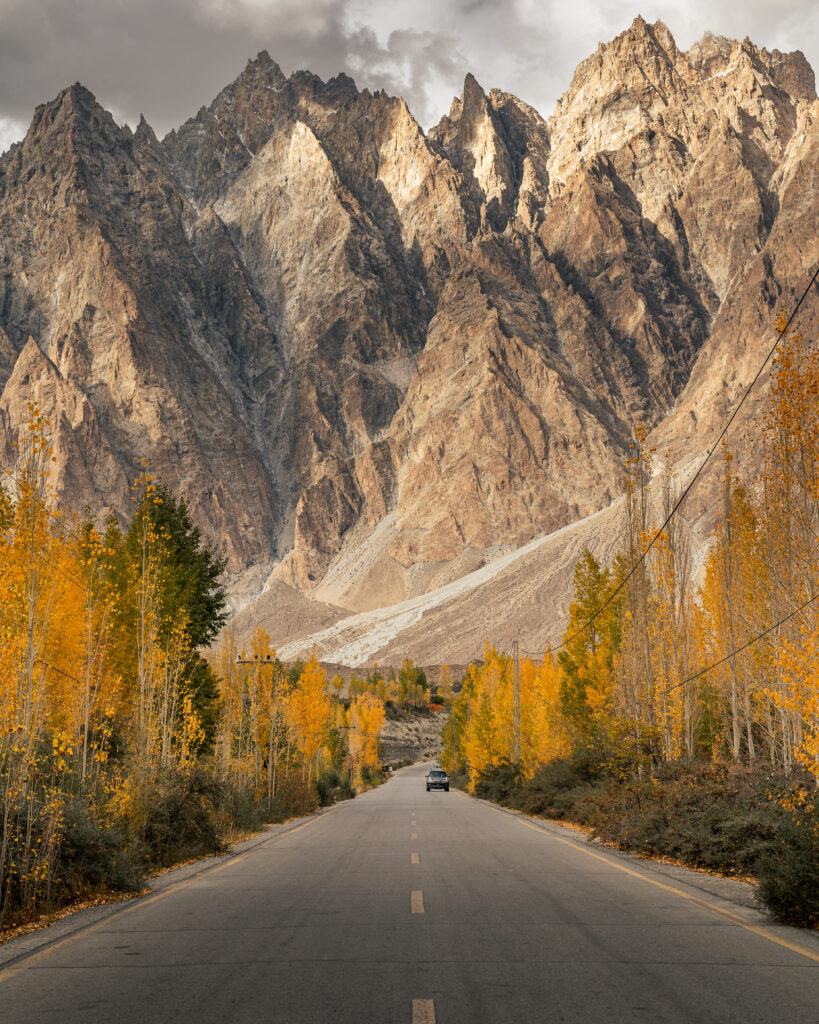
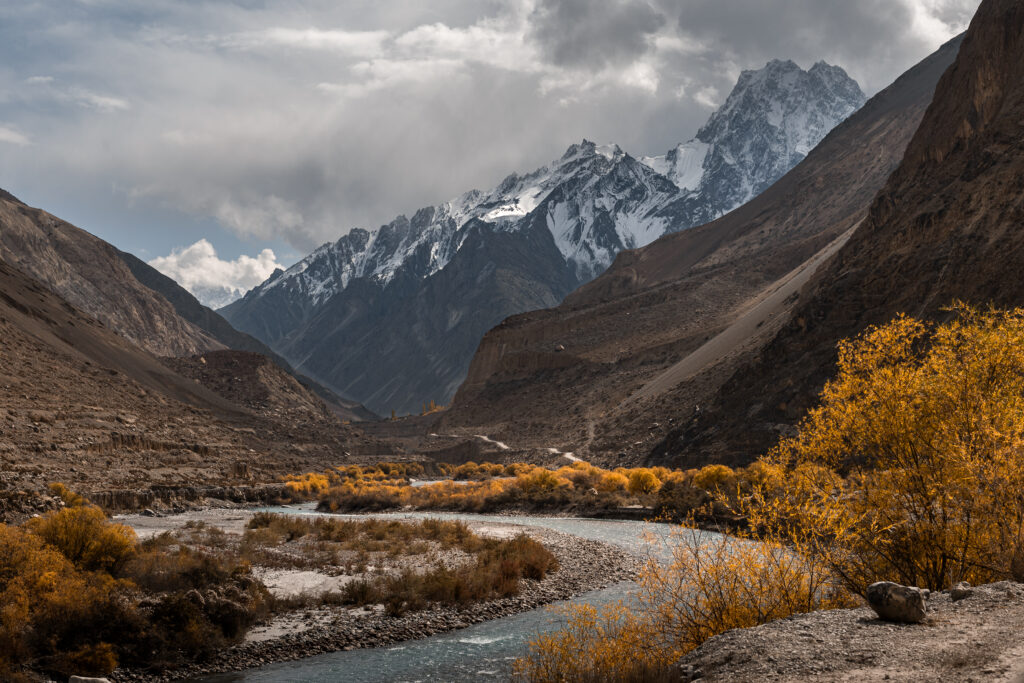
Upper Hunza, also known as Gojal, begins roughly where the Karakoram Highway climbs past the Attabad tunnel and stretches north to the Chinese border at Khunjerab Pass. It feels noticeably different from Lower Hunza. The landscapes are harsher and more open, the villages are smaller and more spread out, and daily life feels quieter and less tourist-oriented. Wide river valleys, glaciers spilling down from towering peaks, and small Wakhi villages scattered along the highway define this part of the journey.
If you’re travelling the Karakoram Highway independently, Upper Hunza deserves more than a passing stop. This guide covers getting there, getting around, where to stay, what to do, and reaching more remote places like Chapursan, Shimshal, and the Patundas Meadows, that most travellers miss entirely.
How to Get to Upper Hunza
Most travellers reach Upper Hunza from Karimabad or Gilgit, travelling north along the Karakoram Highway. Shared vans and minibuses run regularly from both Gilgit and Aliabad toward Gulmit, Passu, and Sost. Vehicles depart when full rather than on fixed schedules, so the earlier you head to the transport stand, the better.
From Aliabad, the drive to Attabad Lake takes around 45 minutes. Passu is roughly a further 30-40 minutes north from there. There’s no set timetable: shared vans leave when full, and fares are low. Hitchhiking along the KKH is also common and works well in this stretch.
If you’re coming from China via the Khunjerab Pass, Sost is the first major settlement in Pakistan and the customs and immigration point. From Sost you can pick up transport south to Passu, Gulmit, and further into Hunza.
For full transport details on getting to the region from Islamabad or Gilgit, see the main Hunza Valley travel guide and the Karakoram Highway public transport guide.
Getting Around Upper Hunza
Getting around Upper Hunza is straightforward as long as you’re flexible with timing. The Karakoram Highway connects all the main villages: Shishkat, Gulmit, Ghulkin, Passu, and Sost, and shared vans pass through regularly throughout the day.
For destinations off the highway, shared or private jeeps can be arranged through guesthouses or at local transport stands. Hitchhiking is reliable and widely accepted along this stretch of the KKH. Traffic is regular enough that you won’t wait long, and locals are generally happy to offer lifts.
The distances between villages are small, Gulmit to Passu is around 15km, so movement between them is quick once you have a vehicle. The challenge is less distance and more timing: vehicles run earlier in the day, and late afternoon options thin out fast.
How Much Does It Cost in Upper Hunza?
Upper Hunza is slightly cheaper than Lower Hunza in practice, mainly because homestays that include meals (breakfast and dinner) are the standard accommodation option. This removes the food cost variable almost entirely and makes daily budgets very predictable.
| Expense | Budget |
|---|---|
| Accommodation (homestay with meals) | 2,000-5,000 PKR |
| Meals (if eating out) | 800-1,500 PKR |
| Local transport (shared van/hitchhike) | 150-400 PKR |
| Activities | Mostly free |
| Daily total | ~€10-20 |
A few notes:
Avoid ATM fees with Wise
The card I use for all my travel withdrawals – real exchange rate, low fees.
Use Revolut to avoid ATM fees
Good alternative to Wise – I carry both as a backup.
Best Things to Do in Upper Hunza
Attabad Lake & Baskoshi Meadows
Attabad Lake is one of the most striking landscapes in northern Pakistan. Created in 2010 when a massive landslide blocked the Hunza River, the lake stretches for several kilometres, its intensely turquoise water sitting in sharp contrast against the bare, rocky mountains above. The road now passes through tunnels blasted through the rockfall, which gives some sense of the scale of the original disaster.
Most travellers see Attabad from the road or take a quick boat ride on the lake itself. Both are worth doing, but the best view of Attabad is from above. The hike to Baskoshi Meadows climbs steeply from the lakeshore to a high vantage point with sweeping views over the lake and surrounding valleys. It’s a short to moderate hike that can be done independently and gives a perspective of Attabad that few casual visitors ever see.
Gulmit & Ghulkin
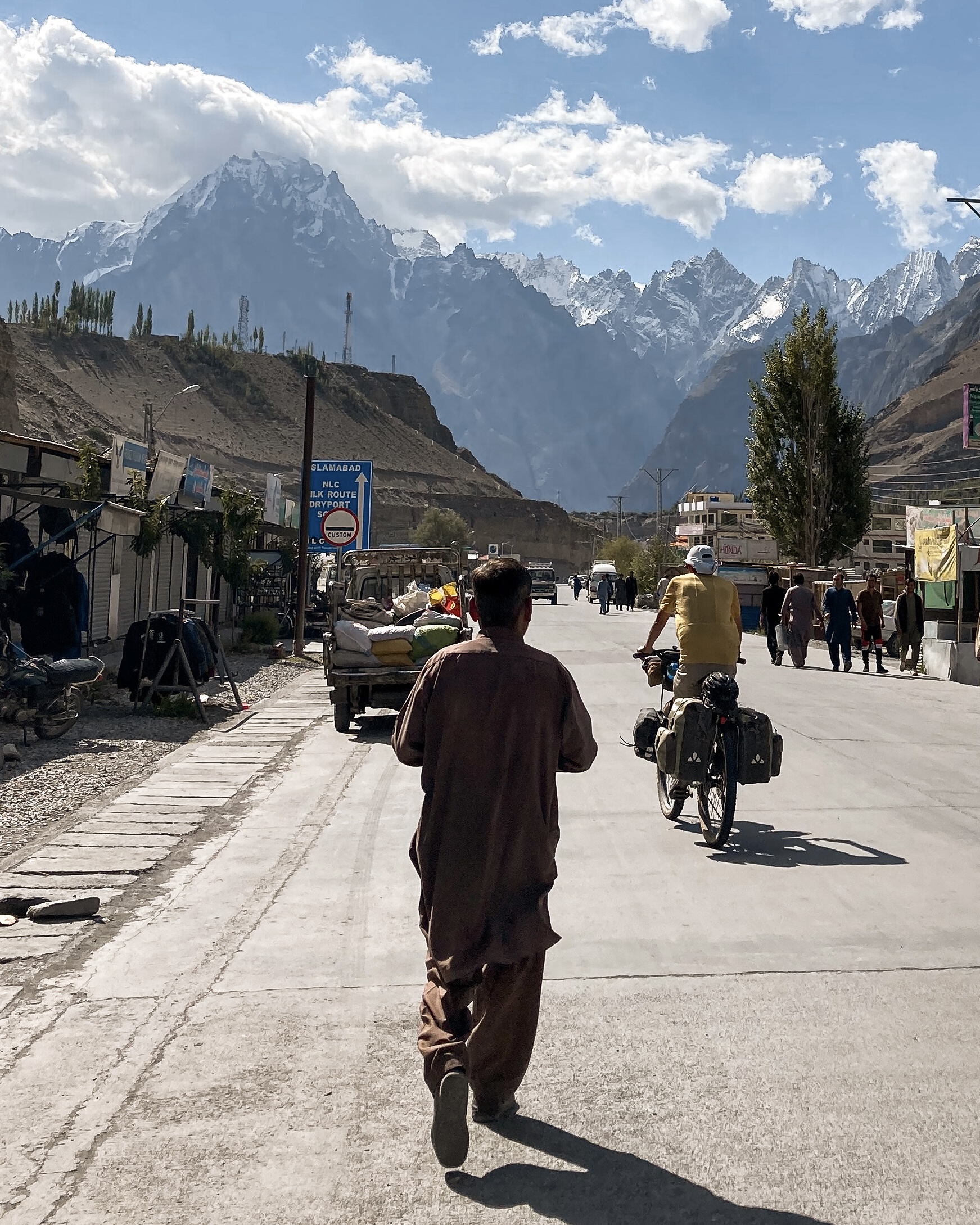
Gulmit is the main village in Upper Hunza and the most practical base for exploring the area. It sits just off the Karakoram Highway with basic guesthouses, a few small restaurants, and transport connections north and south. It’s not the most scenic village in the region, but it works well as a logistical hub.
Ghulkin is the village I’d actually recommend staying in if you want to slow down. Tucked about ten minutes’ drive up into the mountains from the highway, it sits in a quieter, more dramatic setting, with glaciers and peaks visible from the village itself. Several treks start right from Ghulkin, and it’s not unusual to spot ibexes on the surrounding slopes, sometimes visible from the guesthouse in the morning. The atmosphere is peaceful in a way that Gulmit, sitting right on the highway, isn’t.
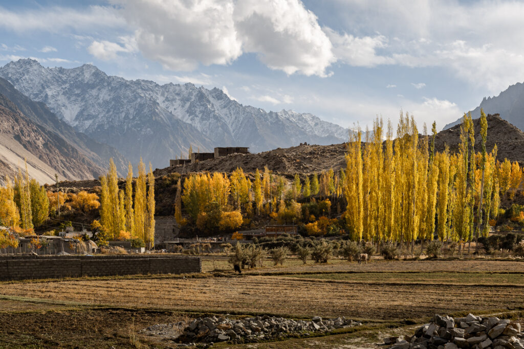 Ghulkin village in Autumn
 Ghulkin village in Autumn
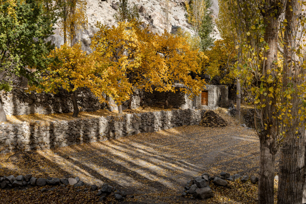 Ghulkin village in Autumn
Borith Lake
Borith Lake is a short detour from the highway between Gulmit and Passu. It’s a calm, shallow lake in a wide open setting with clear views of the surrounding peaks. It’s not a dramatic destination in the way Attabad is, but it’s a pleasant place to walk along the shoreline and it’s rarely crowded. Worth an hour or two if you’re already in the area.
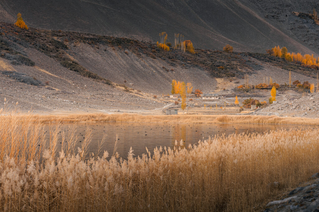 Borith Lake
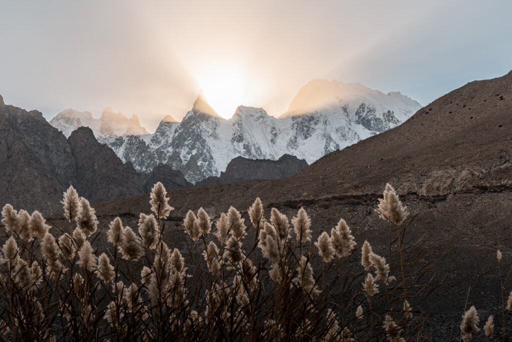 Sunset at Borith Lake
White Glacier Viewpoint
About half an hour north of Passu, the White Glacier Viewpoint Trek is a moderately challenging hike with a dramatic payoff, a close view of glacial ice against the high peaks of the Karakoram. The trailhead is the same starting point as the longer Patundas Meadows Trek (see below). The White Glacier viewpoint can be done as a shorter day hike if you don’t have time for the full three-day route.
 White Glacier Viewpoint
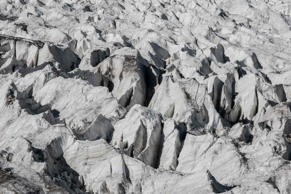 Ice details of Passu Glacier
Patundas Meadows
The Patundas Meadows Trek is a three-day route from near Passu that climbs through high-altitude pastures with direct views of Shispare Peak and Passu Glacier. It starts from the same trailhead as the White Glacier Viewpoint hike but it requires to cross the Passu Glacier and therefore you need to hire a guide. The old shepherd’s huts at the meadows, the wide open terrain, and the absence of other trekkers make this one of the best treks in northern Pakistan that most people haven’t heard of. Check out all the information on how to arrange this trek, which is one of my all-time favourites:
→ Full guide: Patundas Meadows Trek
 Old Shepherd’s Huts at Patundas Meadows
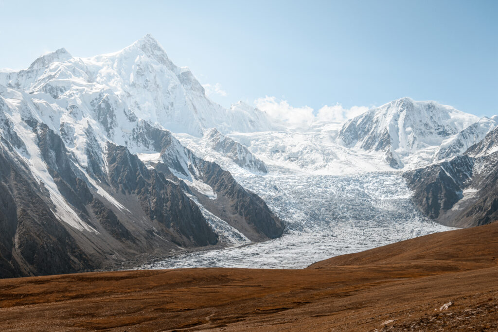 Views of Shispare Peak and Passu Glacier at Patundas Meadows
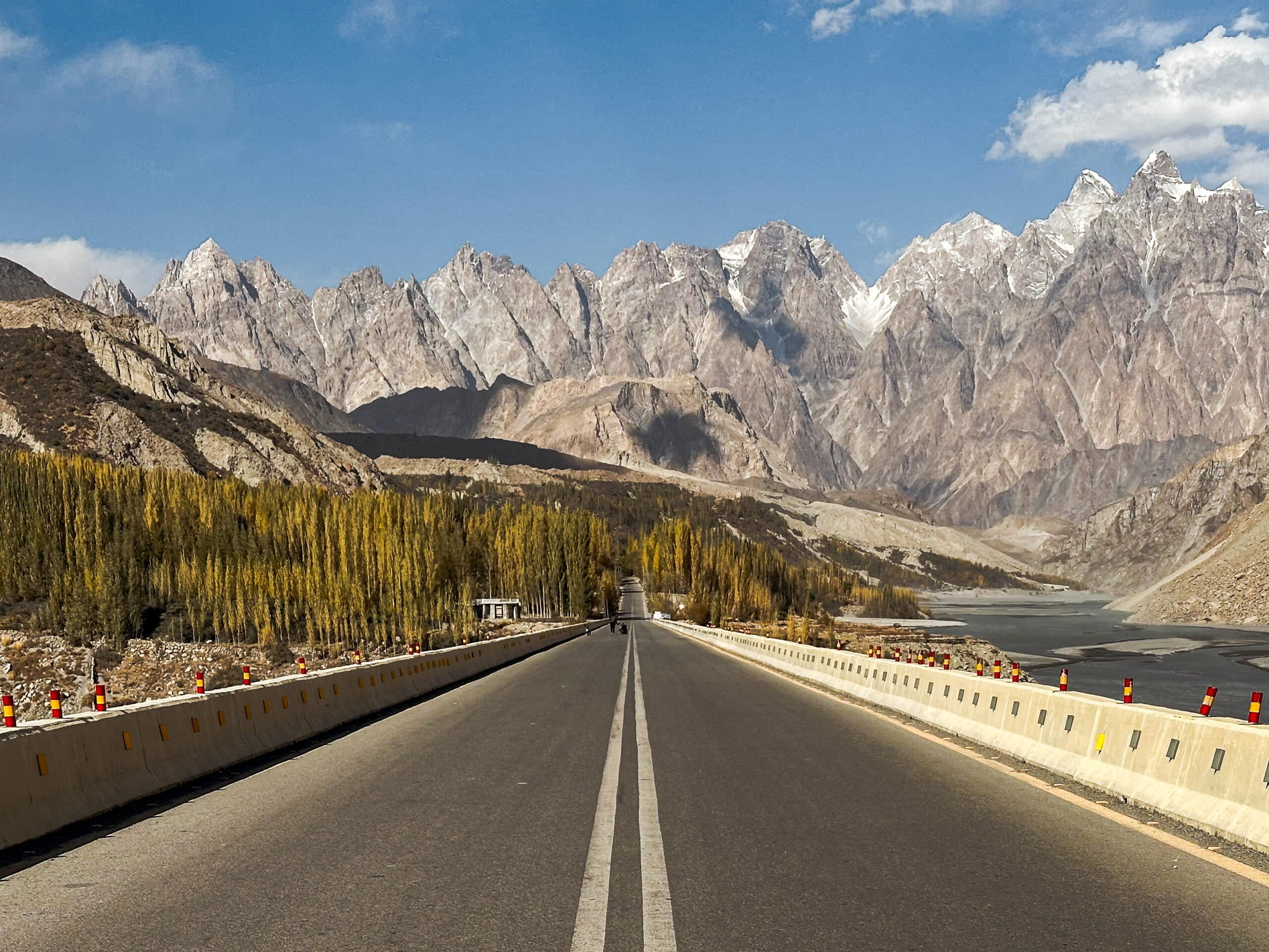
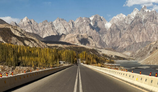
Passu: Cones, Bridges & Glacier
Passu is the furthest north most independent travellers get in Upper Hunza before turning back or continuing to China. The village is small, but the setting is extraordinary. The jagged ridgeline of the Passu Cones (also called the Cathedral) rises sharply behind it, and the Passu Glacier spills down from the peaks above.
 Passu Cones while on the Karakoram Highway
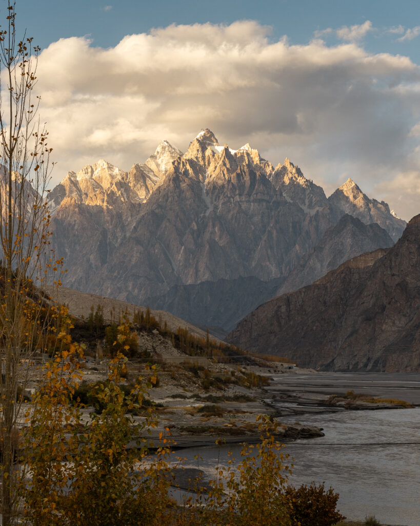 Passu Cones (Cathedral) at Sunset
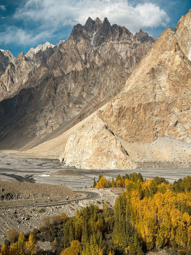 Karakoram Highway and Passu Cones
The Two Bridges
The area has two suspension bridges across the Hunza River, and they’re worth comparing.
The Hussaini Bridge is the famous one. It sees tour buses at sunset, it appears on every Hunza photo compilation, and it’s the one people cross for the Instagram shot with the Cones in the background. It’s busy, and the walk across is honestly not as scary. Worth seeing, but don’t expect to have it to yourself.
The Passu Bridge is longer, older, and considerably sketchier. Sections feel genuinely precarious, and most travellers who walk it will have it to themselves. The views of the river and surrounding peaks are spectacular. The trailhead starts here, a dirt path from the main highway. It’s the better experience of the two if you’re choosing one.
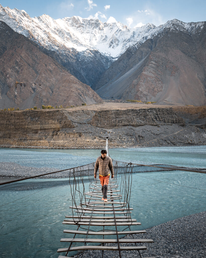 Passu Bridge
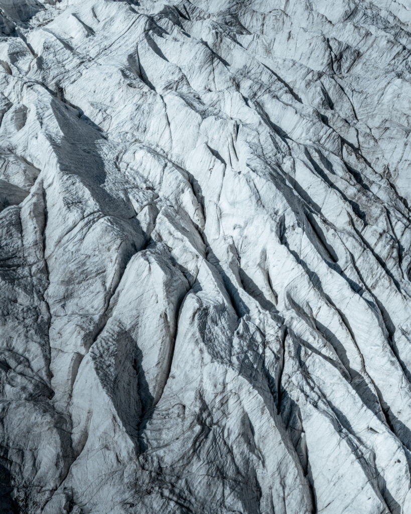 Passu Glacier Details
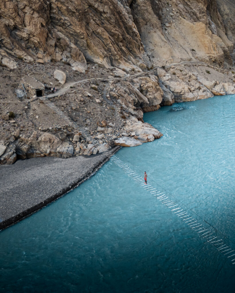 Passu Bridge
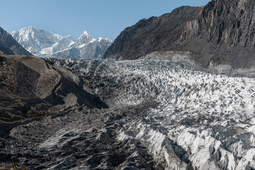
Passu Glacier
The glacier is visible from the village, but getting closer reveals the scale and texture of the ice in a way the roadside view doesn’t. The combination of the Cones, the glacier, and the bridges makes Passu one of the most visually concentrated areas in all of northern Pakistan.
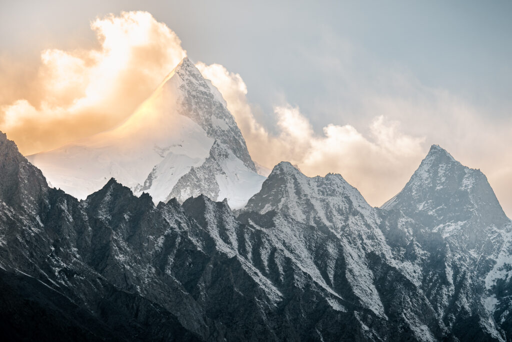 Sunset Shispare Peak at 7611 meters
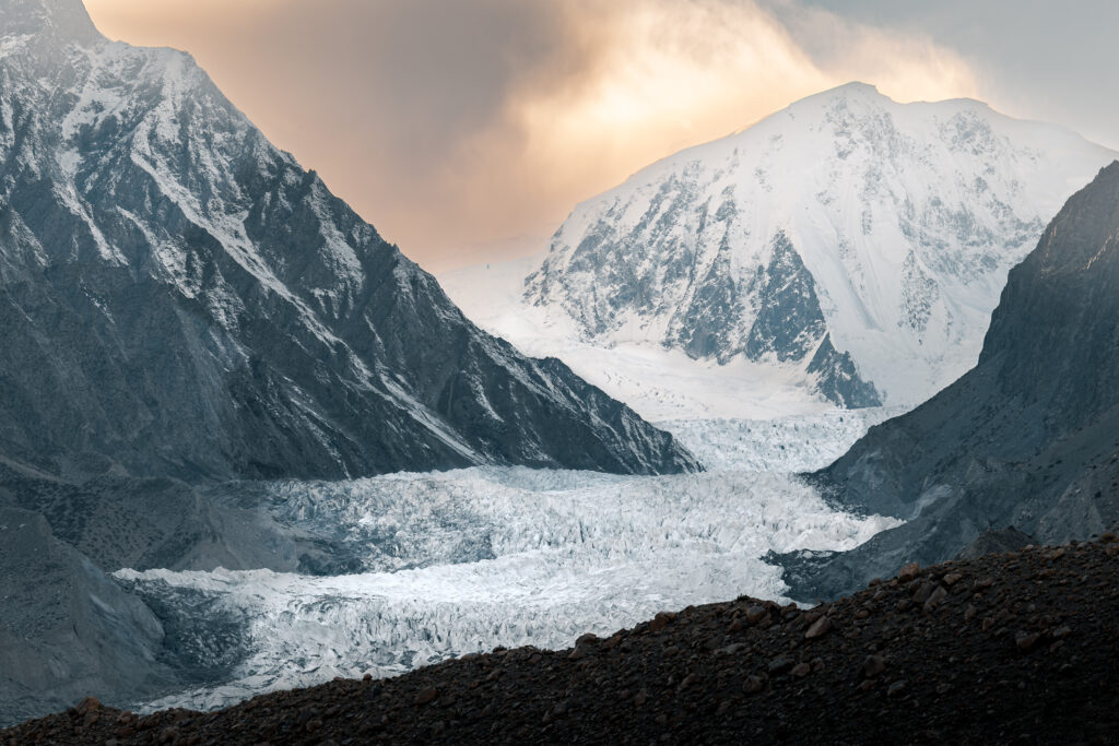 Passu Glacier Sunset
Continuing North: Sost & Khunjerab Pass
Sost
Sost is the last major settlement before the Chinese border and the official customs and immigration point for travellers crossing into Xinjiang. It’s not somewhere people come to linger, but it’s a necessary stop on the northern KKH and more useful than it gets credit for.
The town sits in a wide, arid valley with a frontier feel: dusty streets, truckers, a row of basic guesthouses and restaurants catering to people in transit. If you’re arriving from China, this is where the paperwork happens and where Pakistan begins in earnest. If you’re heading north, it’s the last place to stock up on cash, food, and a working SIM before the border zone.
Sost is also the starting point for both Chapursan Valley and Misgar, the two remote side valleys covered below. If you’re planning to visit either, you’ll pass through Sost regardless, and it makes a practical overnight stop between the KKH and those detours.
Transport south to Passu, Gulmit, and Karimabad runs from the main road through the day, though options thin out in the afternoon. For full transport details in both directions, see the Karakoram Highway public transport guide.
Khunjerab Pass
At 4,693 metres, Khunjerab Pass is one of the highest paved international border crossings in the world, and the point where the Karakoram Highway crosses from Pakistan into China. Even if you’re not crossing, the drive up from Sost is worth doing: the landscape becomes increasingly stark and lunar as the road climbs, the air noticeably thinner, and the pass itself sits in a wide, wind-scoured plateau with views that feel genuinely unlike anywhere else on the KKH.
The pass is inside Khunjerab National Park, home to snow leopards, Marco Polo sheep, and ibex, though wildlife sightings require patience and luck rather than a simple walk to the gate. The park entry fee is collected at the park gate before the ascent. The amount varies depending on whether you’re a local or a foreigner, but expect to pay the steep fee of 5600 PKR (20$) or more (40$) as a tourist (cash only). It’s worth the drive up regardless, both for the scenery and for the strange satisfaction of standing at the roof of the Karakoram.
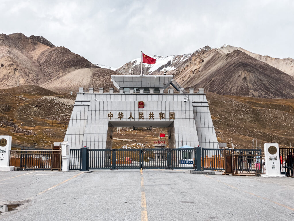 Chinese Border
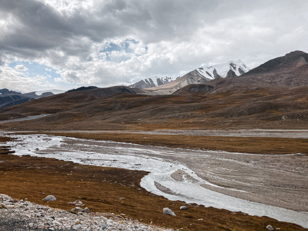 Khunjerab Pass
A few practical points:
Remote Side Valleys of Upper Hunza
This is where Upper Hunza shifts from impressive to genuinely extraordinary. Three side valleys branch off from the Gojal region and each one could easily occupy several days on its own.
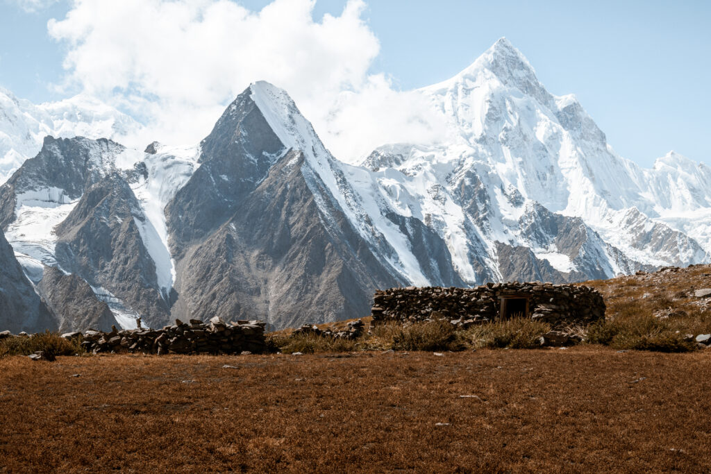
Shimshal Valley
Shimshal sits at over 3,100 metres and is connected to the rest of Hunza by one of the most dramatic roads in Pakistan: a narrow track cut into the mountainside above a deep gorge. The valley is the highest permanently inhabited settlement in Hunza and has a long tradition of high-altitude mountaineering. It’s significantly more remote than anything along the KKH and rewards travellers who make the effort to get there.
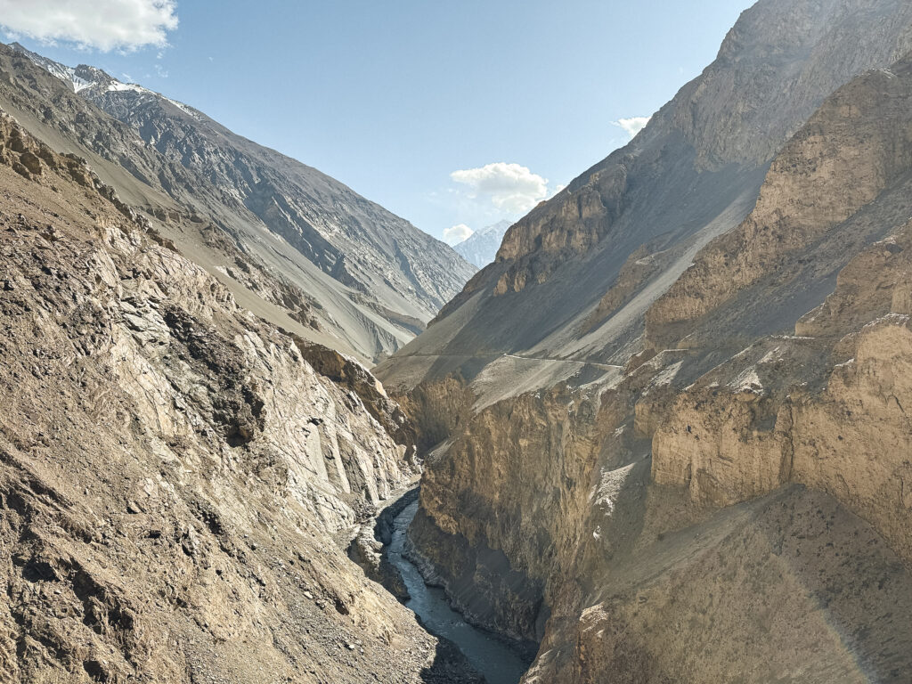 Road to Shimshal Valley
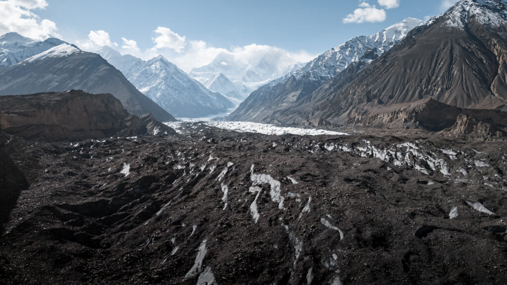 Massive Glacier in Shimshal Valley
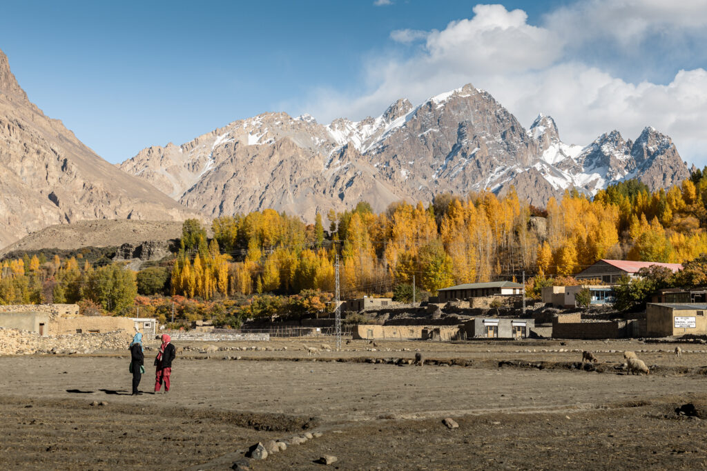 Village in Shimshal Valley
Misgar Valley
One of the most intriguing is Misgar Valley, a rugged and windswept region nestled near the tri-border intersection of Pakistan, China, and Afghanistan. This high-altitude valley once lay along a branch of the ancient Silk Road and today remains home to a small Wakhi-speaking community. Misgar’s expansive meadows and surrounding mountains offer a stark beauty that feels worlds away from the more travelled parts of Hunza.
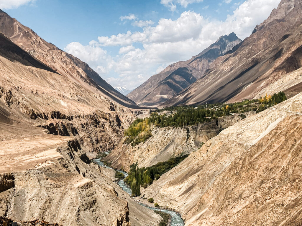 Journey towards Misgar Valley
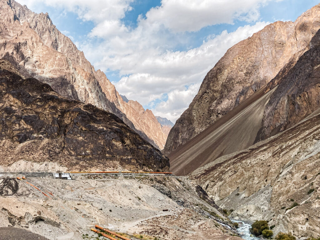 Deep into Misgar Valley
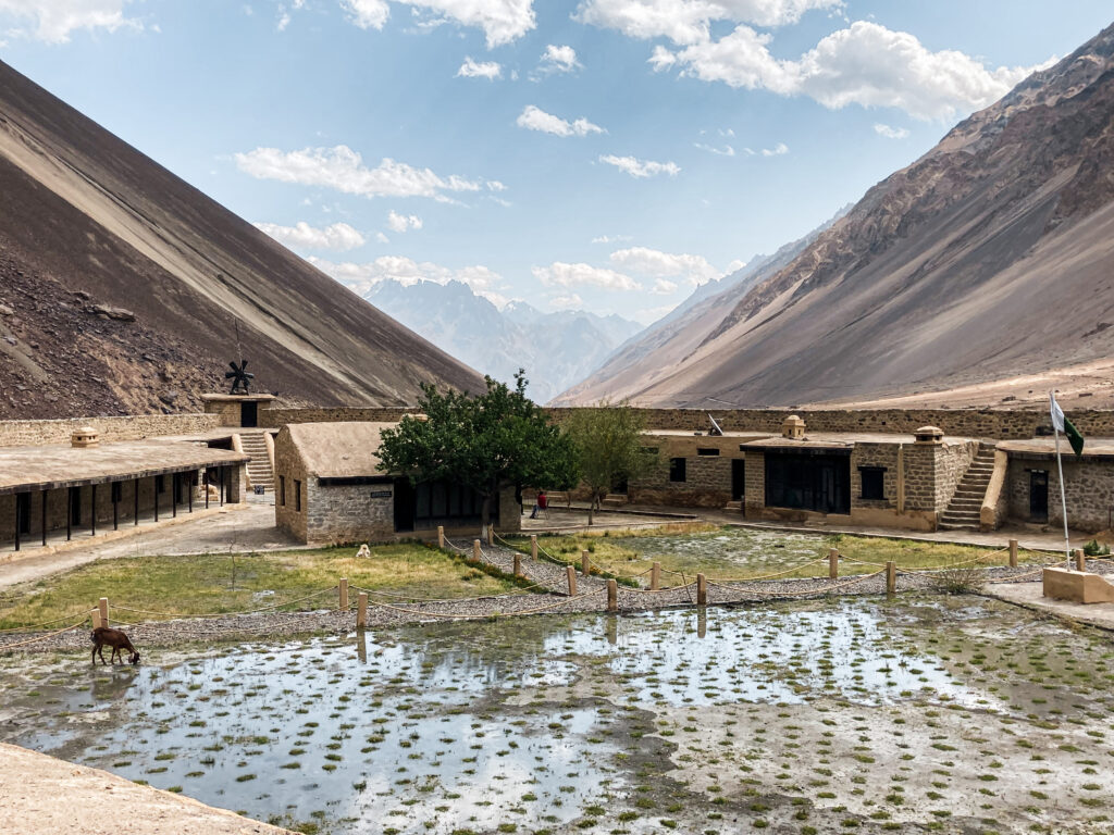
A highlight here is the historic Misgar Fort (also called Kalam Darchi Fort), perched near the strategic confluence of borders. Built by the British in the early 20th century, the fort once served as a military outpost to monitor cross-border movement and remains a fascinating, if remote, relic of colonial-era frontier politics. For more details on Misgar and other valleys check out my post on remote valleys in Northern Pakistan.
Chapursan Valley
Chapursan is the most remote of the three. It runs northwest from near Sost toward the Afghan border, ending at small Wakhi villages that sit in one of the loneliest and most dramatic landscapes in Pakistan. The valley borders the Wakhan Corridor and the sense of isolation is real, this is not a place you wander into accidentally. For anyone travelling the Pamir circuit or interested in the Wakhan, Chapursan is an essential addition.
→ Full guide: Chapursan Valley
 Chapursan Valley
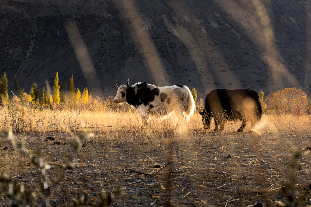 Yaks Grazing in Chapursan Valley
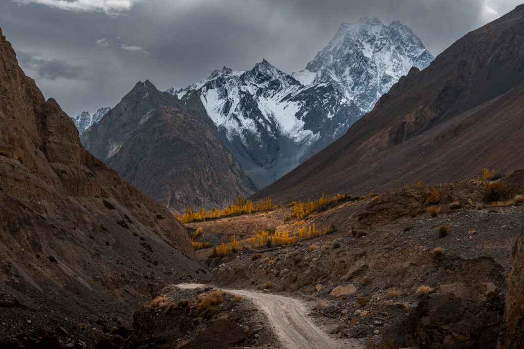 Autumn Colours in Chapursan Valley
Where to Stay in Upper Hunza
Ghulkin is my top recommendation for a base in Upper Hunza. It’s quieter and more beautiful than Gulmit, a short drive from both Borith Lake and the Passu area, and the treks starting from the village itself are excellent. My friends run Rehman’s Homestay in Ghulkin: meals are included, made with fresh local ingredients, and staying there feels genuinely like being part of the family rather than checking into accommodation.
In Gulmit, Rehman Backpacker’s Hostel is the reliable budget option right on the highway and works well if you want easy transport access.
In Passu, The Cathedral has a few basic guesthouses and homestays for travellers passing through. Staying in Passu itself makes sense if you’re doing the full bridge walk, the glacier, and an early start on the White Glacier hike.
Most homestays in Upper Hunza includes meals (breakfast and dinner), so factor this into cost comparisons. A seemingly more expensive homestay that includes breakfast and dinner is nearly always better value than a cheaper room where you’re eating out.
Eating in Upper Hunza
Food options in Upper Hunza are simple compared to Karimabad, and most of the best eating happens in homestays rather than restaurants. That said, two spots in Passu stand out.
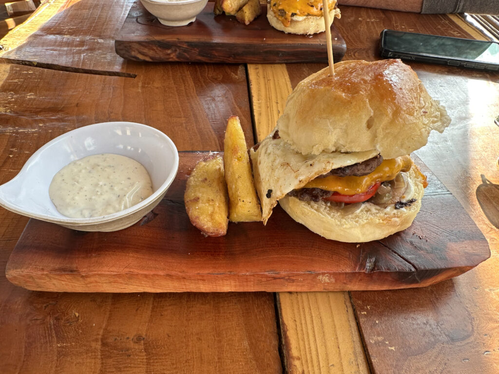
Yak Grill is one of my favourite places to eat anywhere in Pakistan. The yak burgers are genuinely good, the vibe is exactly what you’d want from a restaurant on a legendary mountain road: stickers on the doors, traveller energy, expedition atmosphere, and the view across to the Passu Cones is hard to beat.
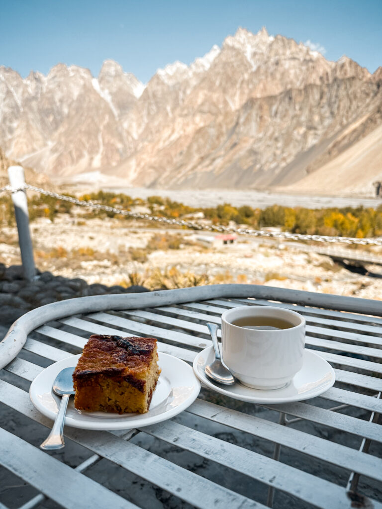
Directly across the street, up a few stairs, is Glacier Breeze. This café has excellent sightlines to both the Cones and the Passu Glacier, and the apricot cake, a traditional Hunza dessert, is delicious. Stop here for tea and cake at minimum.
In Gulmit, there’s a beautiful wooden café built entirely from local timber, worth a visit for the craftsmanship and atmosphere as much as the coffee.
 Apricot cake at Glacier Breeze
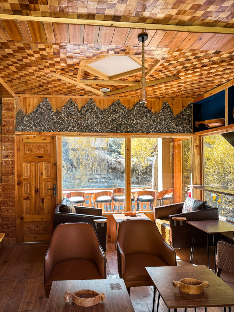 Cafe in Gulmit
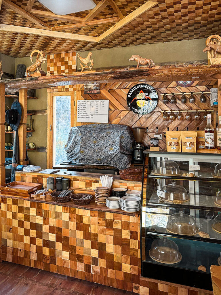 Cafe in Gulmit
If you’re staying in Ghulkin or a more remote village, lean on your homestay for meals. Fresh local ingredients, home cooking, and often a better feed than anything the restaurants in Passu offer.
Practical Tips for Upper Hunza
Cash: Withdraw before leaving Aliabad. Alfalah Bank there is the last reliable ATM for foreign cards. Sost has basic banking but don’t count on it.
SIM card: SCOM is the best network for Upper Hunza and Gojal. Get a SIM from their office in Aliabad. Coverage exists along the KKH but drops in side valleys.
Need data before you land? Try Saily eSIM
Use code RITAHE1486 for $5 off your first plan.
Permits: No special permits are required for Gulmit, Ghulkin, Passu, or the main hikes. Some areas closer to the Chinese border (Khunjerab Pass zone) have checkpoints, carry passport and visa copies at all times.
Altitude: Upper Hunza sits at 2,700-3,000m. The side valleys climb considerably higher. Don’t push hard on day one if you’ve come straight from Gilgit or lower elevation.
Seasonality: The KKH to Passu is accessible most of the year. Khunjerab Pass typically closes from November to April. Side valleys like Shimshal may have limited access in deep winter.
Frequently Asked Questions about Travelling Upper Hunza
No. All the main sites: Baskoshi Meadows, Borith Lake, White Glacier Viewpoint, the Passu Bridge walk, can be done independently without a guide or permit. However, for the Patundas Meadows Trek hiring a local guide is highly recommended.
Three to four days covers the main stops along the KKH: Attabad Lake, Ghulkin, Borith Lake, and Passu. Five to seven days allows you to add one of the side valleys. If you want to do Patundas Meadows (three days), Shimshal, and Chapursan, factor in ten days to two weeks for Upper Hunza alone.
Yes. Upper Hunza is one of the safest areas in Pakistan for solo women. The Wakhi culture in Gojal is liberal by Pakistani standards, and female travellers are a common sight along the Karakoram Highway. Modest dress is appreciated in smaller villages. For a fuller picture of solo female travel in Pakistan, see the dedicated guide.
Yes. Sost is the Pakistani border town and the Khunjerab Pass leads into Xinjiang. The crossing is open seasonally and requires a valid Chinese visa. Check current status before planning as border crossing schedules and rules in this area shift.
Need help planning your Pakistan trip?
Custom itineraries, local guide sourcing, and on-trip support from someone who’s done it.
More Pakistan Travel Guides
If you’re planning to travel Pakistan independently, these in-depth guides will help you navigate the country, travel on a budget, and explore far beyond the usual routes:
Have questions about Upper Hunza or Gojal? Drop them in the comments, I read every one.