
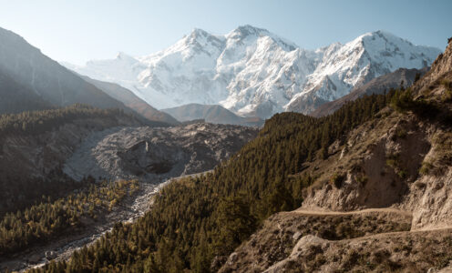
If you’re planning on trekking in Pakistan, you’re in for one of the most rewarding mountain experiences on the planet. Pakistan is home to some of the world’s most dramatic landscapes: five of the world’s fourteen 8,000-metre peaks, hundreds of glaciers, and remote high-altitude valleys that see a fraction of the visitors that flock to Nepal or the Alps. Whether you’re after a short day hike above Hunza Valley or a multi-day expedition into the Karakoram, the options are extraordinary.
Unlike other famous trekking destinations, Pakistan remains largely untouched by mass tourism. There are no crowds, no teahouse networks, and very little of the infrastructure that softens the adventure elsewhere. This gives the trails here a much wilder, more authentic feel. You’ll be walking through pristine landscapes, staying in remote villages, and often sharing the trail only with local shepherds.
This is also changing fast. International interest in Pakistan’s trekking potential has grown significantly in recent years, and it won’t be long before this becomes one of the world’s most recognised trekking destinations. If solitude, raw beauty, and genuine adventure are what you’re after: now is the time to go.
This guide covers the best treks in Pakistan for independent travellers, from accessible day hikes to multi-day treks, along with essential tips on permits, guides, costs, safety, and what to pack.
Essential Tips for Trekking in Pakistan
Best Time to Go
The ideal trekking season in northern Pakistan runs from May to October, with July and August offering the best weather for high-altitude trails. Lower-altitude hikes can be done slightly earlier or later, but always check local conditions – landslides and snowmelt can affect access.
Permits and Paperwork
Some trekking areas are located in sensitive zones and may require permits or passport copies for checkpoints. Always carry multiple photocopies of your passport and visa – it’ll save you time at military checkpoints.
Hiring a Local Guide
While some day and multi-day hikes can be done independently, but many longer routes are poorly marked and pass through remote or glaciated areas where having a local guide is not only safer but actually the only way you’ll ever find the path. Most guides are from nearby villages and offer deep insight into the terrain and traditions. You’re also supporting the local economy directly.
Altitude Awareness
Some treks reach high elevations quickly. Learn the basics of altitude sickness and don’t rush your ascent. Stay hydrated, listen to your body, and build in rest days when needed.
Water & Food
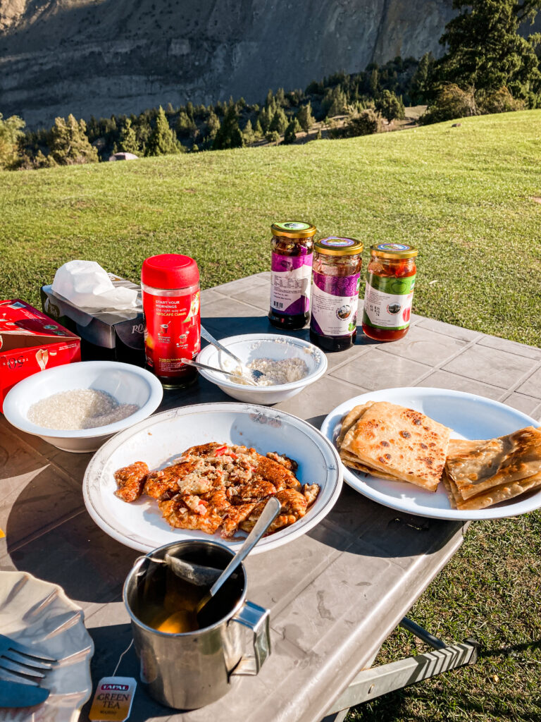
Always carry enough water and snacks: trails in Pakistan are not lined with tea shops like in Nepal. Water from streams or springs should be filtered or treated, and food options can be very basic outside of major towns, so come prepared.
Cultural Sensitivity
Trekking in Pakistan often means passing through small villages where hospitality is strong and traditions are deeply rooted. Dress modestly (especially women), ask before taking photos of people, and be respectful of local customs.
Connectivity & Safety
Mobile coverage is limited in the mountains, and many treks have no signal at all. Share your trekking plan with someone before you go, and consider carrying an offline map app like Maps.me.
What to Pack for Trekking in Pakistan
Even for day hikes, come prepared. Essentials include sturdy hiking boots, layered clothing (temperatures vary a lot between day and night), a good backpack, sun protection, a first aid kit, and a power bank. For multi-day treks, bring a sleeping bag, water purifier (or tablets), and lightweight camping gear unless your trek includes porters or stays in homestays.
How Much Does Trekking in Pakistan Cost?
Trekking in Pakistan is significantly cheaper than comparable destinations like Nepal or Patagonia, especially if you’re organising things independently. Here’s a rough breakdown of what to expect.
Getting to the trailhead Most trailheads are accessible by public transport or hitchhiking. A local minibus or shared van along the Karakoram Highway costs between 200-500 PKR per leg. The most expensive transport cost is the jeep to Fairy Meadows (16,0000-20,000 PKR total, shareable between travellers).
Accommodation on the trail
Guided Treks: For treks that require a guide, like Patundas Meadows, which involves a glacier crossing, the easiest approach is to arrange it directly in the nearest village (Gulmit or Ghulkin) rather than through a tour operator. For Patundas, it costs around $140 total for 3 days per person, which covered everything: transport to the trailhead, guide and porter fees, permits, camping gear, and all meals.
Permits: Most of the treks in this guide require no permits and for Patundas the cost is bundled in when you hire a guide.
Total daily budget on the trail
Budget: (own gear, wild camping or basic guesthouse with meals included): €8-20/day
Guided trek with all-inclusive arrangement (like Patundas): ~$45-50/day total
Before you go: Cash is essential! There are no ATMs on any of these trails. Withdraw enough before leaving Gilgit, Aliabad, or Skardu. The only ATM that reliably works for foreign cards in the region is Bank Alfalah. To avoid losing money on ATM fees and exchange rates, use a Wise or Revolut card. Both give you close to the real exchange rate with minimal fees, which adds up over a longer trip.
Iconic Day Hikes in Pakistan
Not every adventure in Pakistan needs to be a multi-day expedition – the country is full of rewarding day hikes that pack serious punch. From hanging glaciers and dramatic suspension bridges to panoramic alpine meadows, these short treks offer a taste of the wild without the need for heavy gear or complex logistics. Many of them are easily accessible from popular bases like Hunza or Skardu and can be done in a few hours to a full day, making them perfect for acclimatisation, rest days, or those short on time.
These trails are also a great introduction to the raw, unspoiled landscapes that define Pakistan’s north and a chance to experience the same solitude and beauty without committing to a longer expedition. Below are some of the most iconic day hikes that will leave you breathless, both from the effort and the views.
Eagle’s Nest Viewpoint (Karimabad, Hunza)
This classic sunset spot is more of a scenic walk than a hike, but it’s absolutely worth including. Located above the villages of Altit and Karimabad, Eagle’s Nest offers a commanding 360-degree view of the Hunza Valley and several major peaks, including Ultar Sar, Ladyfinger, and Rakaposhi. You can hike up from Altit in about 1-1.5 hours, or take a taxi to the viewpoint. Try to time it for golden hour as the view as the sun dips behind the mountains is legendary.
Baskoshi Meadows (Attabad Lake, Hunza)
Hidden above the shores of Attabad Lake, Baskoshi Meadows is a peaceful alpine spot that rewards hikers with sweeping views over turquoise waters and the dramatic peaks of the Karakoram. The trail starts right from the side of the Karakoram Highway and takes around 2 to 3 hours one way, climbing steadily through terraced fields and pastures before opening up to a high plateau.
The Bridges of Passu (Upper Hunza)
Probably the most photographed day walk in Pakistan, this short but thrilling adventure takes you across two legendary suspension bridges: Hussaini Bridge and Passu Bridge. These rickety wood-and-wire crossings span the Hunza River with nothing but wild currents rushing below. You can start the walk from Hussaini bridge and do a loop or just cross and return. It’s a great mix of adrenaline and stunning views of the Passu Cones.
Black Glacier Viewpoint (Ghulkin, Upper Hunza)
Just outside the peaceful village of Ghulkin, this lesser-known hike offers dramatic close-up views of the Black Glacier, one of the many dynamic glaciers snaking down from the high Karakoram. The walk takes about 2 hours return and leads through farmland, along stone walls, and up a ridge overlooking the glacier’s snout and the surrounding mountains. It’s short, peaceful, and great for getting a sense of how powerful and alive these glaciers are.
Marsur Rock (Skardu)
Perched high above the Shigar Valley in the Skardu region, Marsur Rock is often nicknamed the “Trolltunga of Pakistan” for its dramatic overhang and jaw-dropping views of the surrounding mountains and river valleys. The hike starts just outside Skardu town and takes about 3-4 hours return. The trail climbs through rocky slopes and past shepherd huts before reaching the iconic rock ledge. It’s a steep but rewarding hike, and thanks to its relatively low profile, you’ll likely have the place all to yourself.
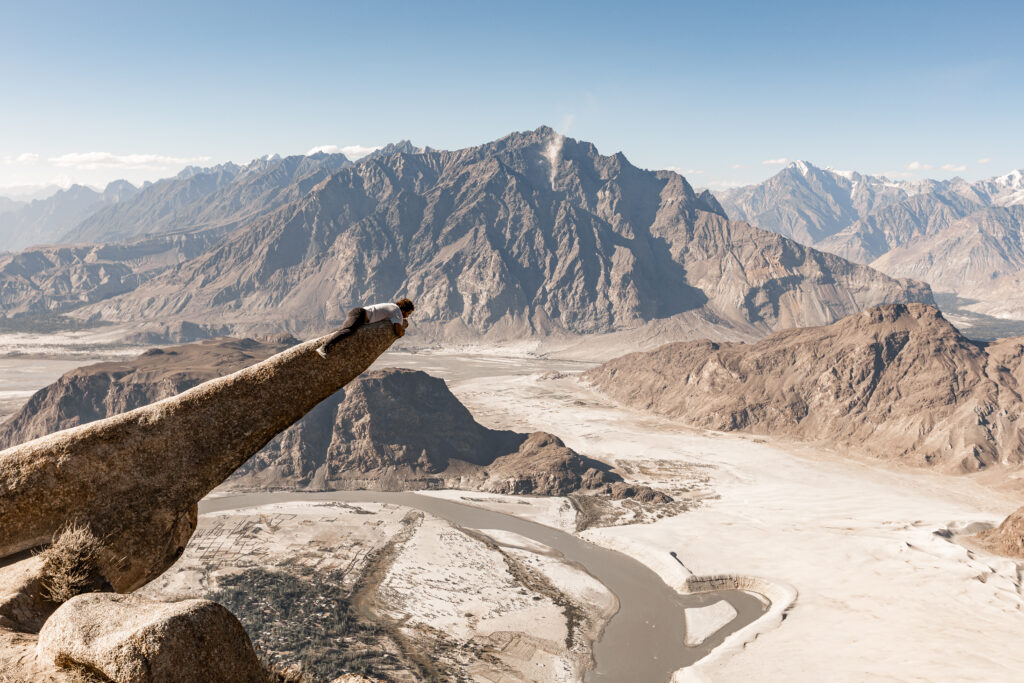 Marsu Rock in Skardu
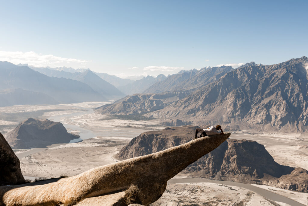 Marsu Rock in Skardu
Multi-Day Treks for the Adventurous
For those craving deeper immersion in the wild landscapes of Pakistan, multi-day treks offer an unforgettable adventure into some of the most pristine and remote corners of the Karakoram and Himalayan ranges. These aren’t just walks: they’re full-on journeys that might take you across glaciers, up to high-altitude meadows, and face-to-face with towering 7,000+ meter peaks.
What makes trekking in Pakistan even more rewarding is the raw, off-the-grid nature of the experience. Unlike the well-trodden trails of Nepal or the Alps, you won’t find teahouse networks or herds of tourists here – just you, your guide (if you hire one), and the wild. Many of these treks require a basic level of fitness, a flexible attitude, and a willingness to embrace discomfort. But the payoff? Deep solitude, untouched nature, and a kind of silence you rarely find in the world anymore.
Here are a few of the most iconic multi-day treks for independent-minded travellers.
Rakaposhi Base Camp Trek (Minapin, Nagar Valley)
The trek to Rakaposhi Base Camp is one of the most accessible multi-day treks in Northern Pakistan and yet offers all the drama of a full-on expedition. Starting in the quiet village of Minapin, just off the Karakoram Highway in Nagar Valley, this trek takes you right to the foot of Rakaposhi (7,788 m) – the 27th highest mountain in the world and one of the most prominent peaks on Earth.
Trek Overview
Best Season: June to October
Duration: 2 days
Elevation gain: ~1,500 metres from Minapin to base camp
Difficulty: Moderate: trail is clear but steep in parts
Accommodation: Hapakun and Taghafari Campsites
Guide? Not necessary, the trail is very clear
I trekked this route solo and without a guide for two days, spending the night at Hapakun Campsite, roughly halfway up. They have pre-set tents with sleeping bags available, which is perfect if you’re not carrying your own camping gear or just want to keep things light. Below is a more detailed breakdown of what each day on the trail looked like.
Getting to the Trailhead
I started the day in Karimabad, which meant a bit of a journey just to reach the trailhead. If you want an easier start, I’d recommend spending the night in Minapin village. From Karimabad, I first took a local van to Aliabad, where I caught a southbound minibus on the Karakoram Highway. The ride cost 250 PKR (less than €1) and dropped me off at the junction where the side road leads to Minapin. From there, it was about a 5 km walk to the start of the trail but it’ll be very easy to hitchhike to Minapin as long as you’re willing to hop on on the back of a motorcycle.
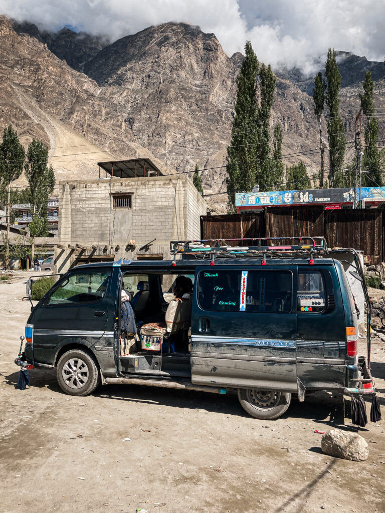
Several locals offered me rides on the back of their motorbikes, but I decided to walk instead – it’s a scenic, peaceful approach. By the time I reached the trailhead, it was already lunchtime, so I stopped for a plate of daal and rice (450 PKR) right next to the starting point. In hindsight, setting off around 1 pm wasn’t ideal – it was early September and still very hot at that time of day.
Day 1: Minapin to Hapakun Campsite
The trail begins just behind Minapin village (here) at an altitude of around 2,000 m. The initial section was exposed to direct sunlight and quite steep, making for a hot and strenuous start. Fortunately, after the first stretch, the gradient eased and the temperature began to cool, making the climb a lot more pleasant.
 Beginning of the Trail
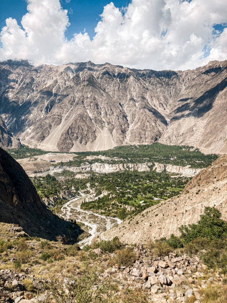 Views over Minapin
The path gently winds through terraced fields and eventually enters a shaded pine forest. Along the way, there are occasional water sources and great views over the valley below. After about 3-4 hours of hiking, I arrived at Hapakun Campsite, sitting at around 2,800 m.
 Hapakun Campsite
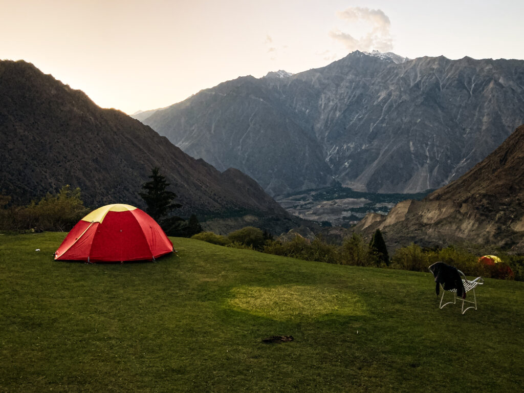 Hapakun Campsite at Sunset
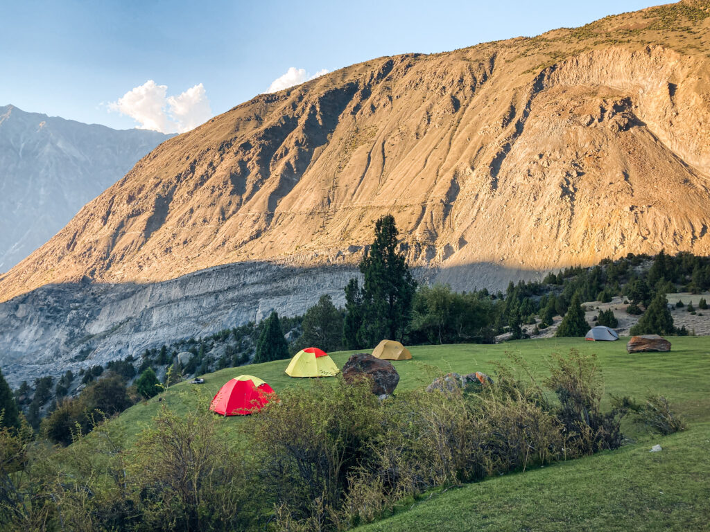
Hapakun is a basic but peaceful forest clearing with several tents already set up (sleeping bags included) which is perfect if you’re not carrying your own gear. The price is usually negotiable and includes dinner and breakfast. I paid around 6,000 PKR (roughly €18) – a bit pricey by Pakistani standards, but worth it for the convenience. The location is quiet and scenic, ideal for watching the sun set through the trees with the crisp scent of pine in the air.
Day 2: Hapakun to Base Camp and Return
The second day is tougher but incredibly rewarding. The trail steepens and becomes rockier as you climb out of the forest and into more open alpine terrain. After about 2-3 hours, you’ll reach Taghafari – a dramatic meadow perched on a ridge with incredible views of Rakaposhi’s ice wall, the Minapin Glacier, and neighbouring Diran Peak (7,266 m).
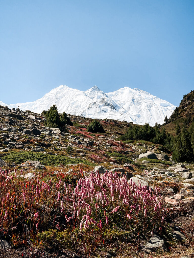 Hiking up to the ridge with views of Rakaposhi
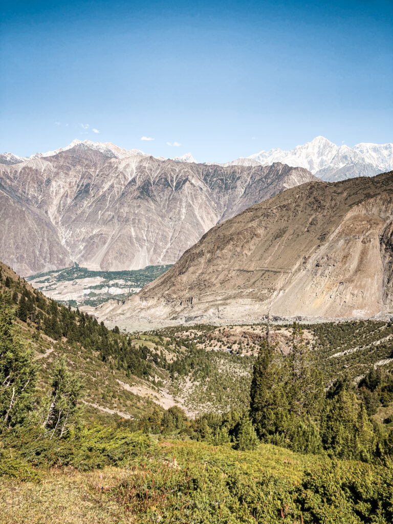 Views of the valley below
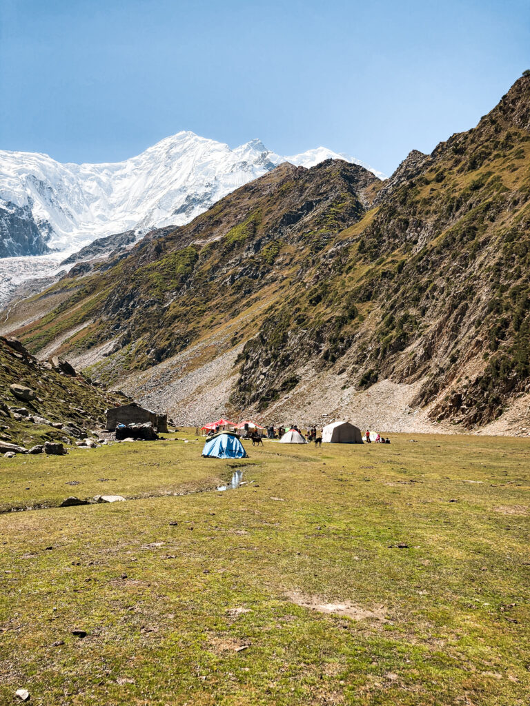 Rakaposhi Base Camp
If you still have energy, you can continue a bit further for even better views of the glacier and surrounding mountains, though be cautious if there’s snow or unstable weather. After soaking in the panorama, retrace your steps all the way back down to Minapin – it’ll take around 3-4 hours depending on your pace.
Fairy Meadows & Nanga Parbat Base Camp
No list of iconic treks in Pakistan is complete without mentioning Fairy Meadows, the legendary alpine grassland at the foot of Nanga Parbat, the world’s 9th highest mountain at 8,126 m. This spot has become somewhat of a rite of passage for travellers venturing north and for good reason.
Trek Overview
Best Season: May to October
Duration: 2 days
Elevation gain: ~1,100 metres from Tatu Village to Base Camp
Difficulty: Moderate
Accommodation: Guesthouses in Fairy Meadows & Beyal Camp
Guide? Not necessary, the trail is very clear
While Fairy Meadows is no longer a hidden gem, its beauty still feels otherworldly, especially, if you stay in one of the quieter guesthouses on the edge of the forest. Just try to avoid weekends and holidays, when domestic tourists often flood the area.
Getting to the Trailhead
Getting to Fairy Meadows is already an adventure in itself. You’ll first travel to Raikot Bridge, located along the Karakoram Highway between Chilas and Gilgit.
From there, you’ll need to hire a local jeep to brave the infamous 16 km dirt road which is often called one of the world’s most dangerous roads. The jeep costs between 16000-20000 PKR. Pro tip: if you’re solo try to find other travellers to share the jeep with and split the cost.
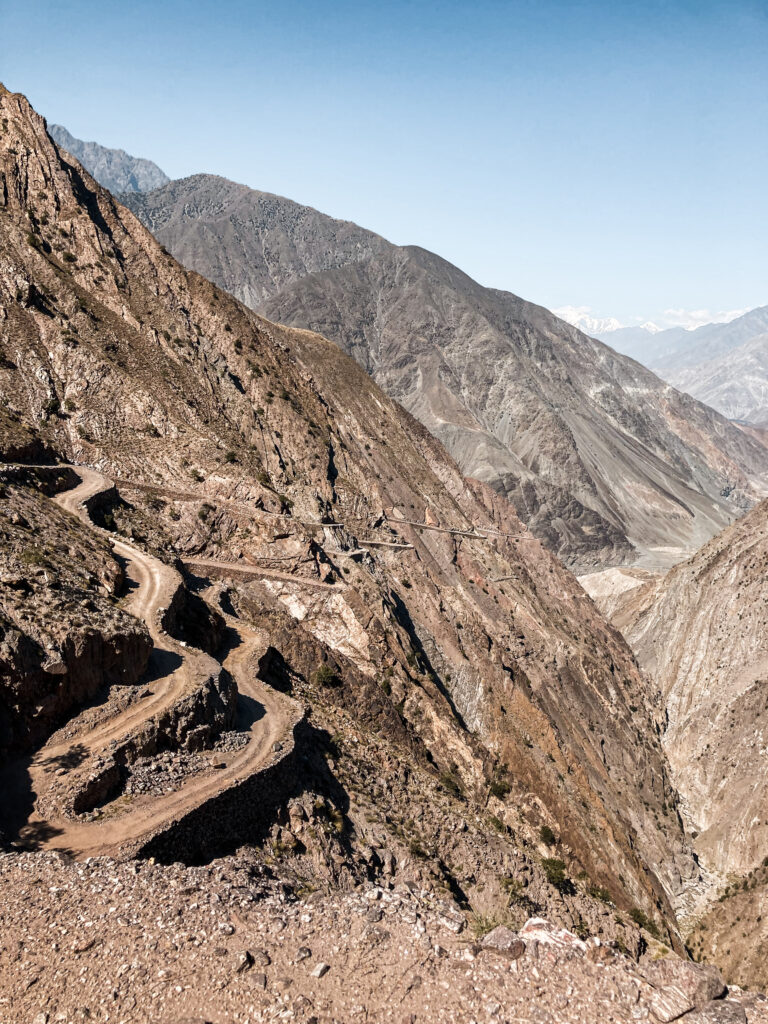 Dangerous Road to Fairy Meadows
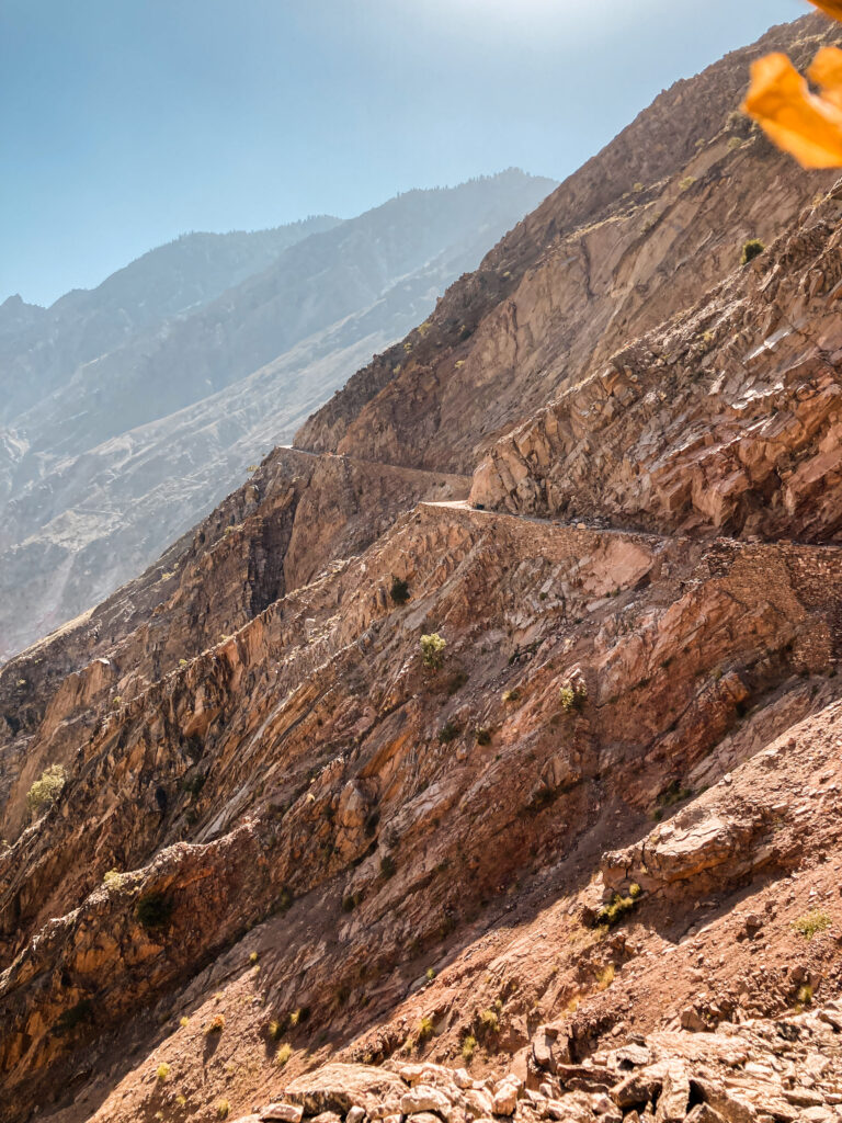 Dangerous Road to Fairy Meadows
 Dangerous Road to Fairy Meadows
Day 1: Scary jeep ride and hike to Fairy Meadows
The jeep ride ends at Tatu Village, from where it’s a 2-3 hour steep uphill hike to reach Fairy Meadows which is at an approximate altitude of 3300 m.
The reward? Lush green meadows, scattered log cabins, and one of the most jaw-dropping views of Nanga Parbat’s north face. Most people spend at least one night here, but it’s worth staying longer if you plan to hike further.
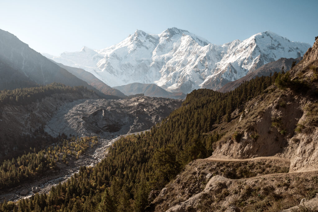 Fairy Meadows
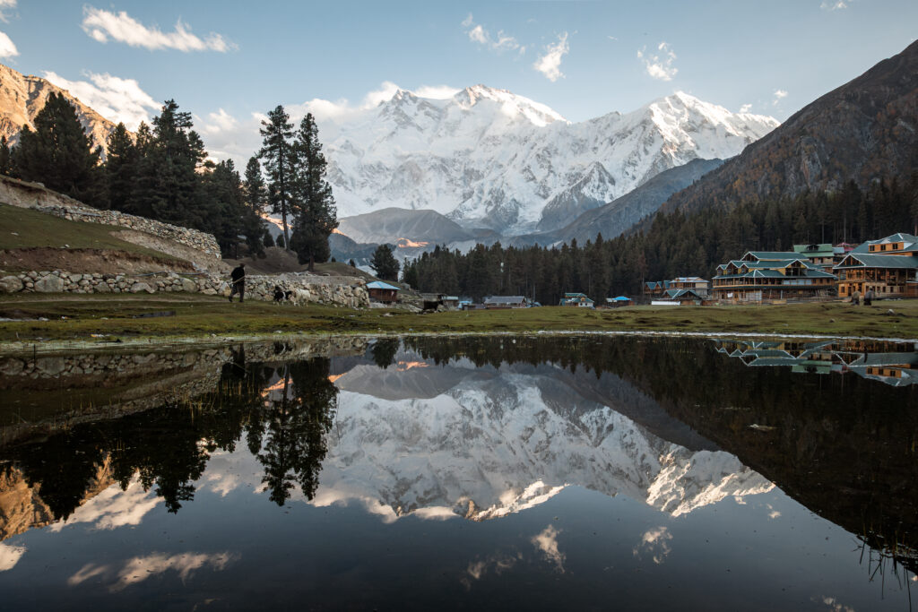 Fairy Meadows with Nanga Parbat reflection
Day 2: Fairy Meadows to Nanga Parbat Base Camp and Return
The trek to Nanga Parbat Base Camp starts from Fairy Meadows and takes 4-5 hours one way, through forest and rocky moraine. It’s a moderately challenging hike, but on a clear day, you’ll get close-up views of the “Killer Mountain” and the surrounding glaciers. It’s possible to do it as a long day hike if you’re well-acclimatised, or camp overnight near the base camp if you’re properly equipped.
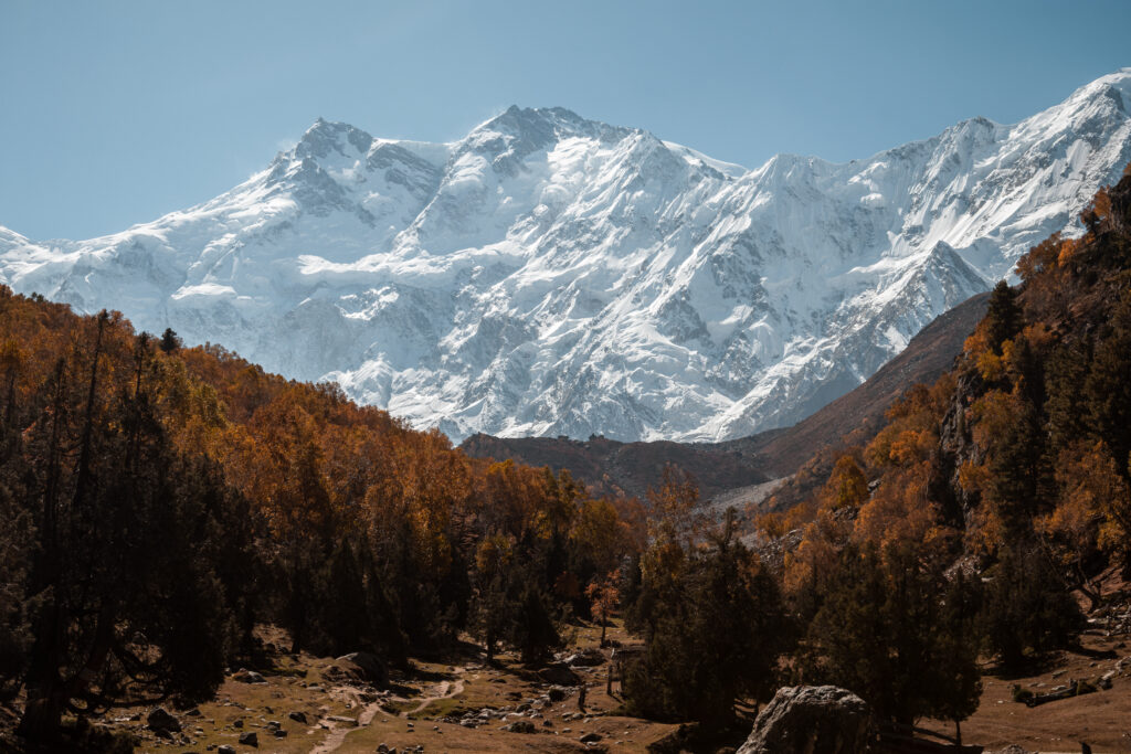 Views of Nanga Parbat
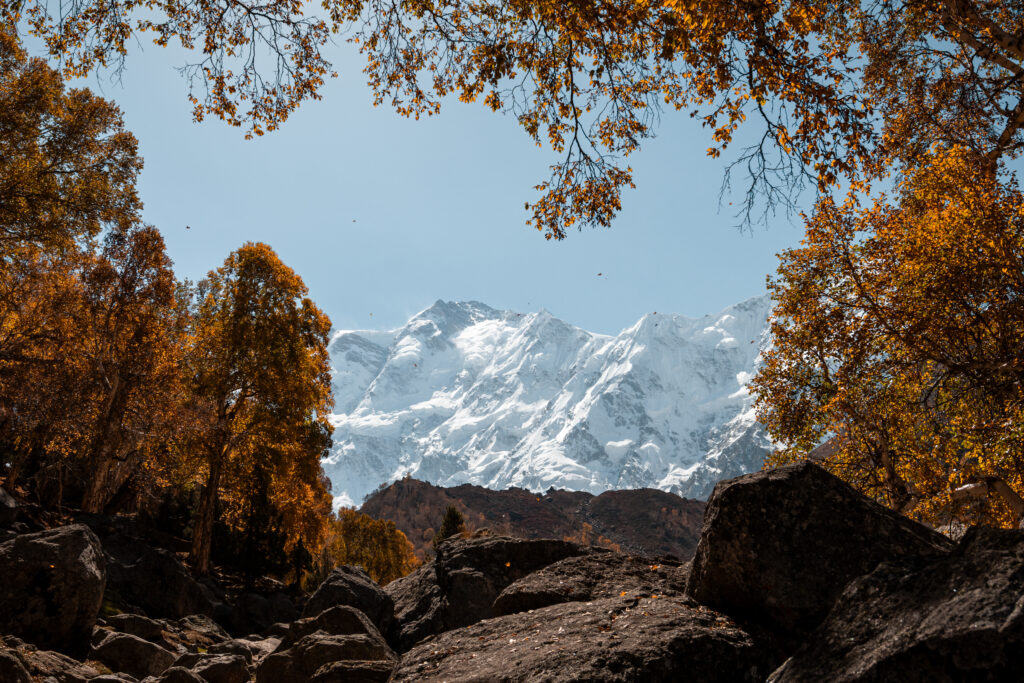 Views of Nanga Parbat through the autumn leaves
Check my detailed guide of Trekking to Fairy Meadows and Nanga Parbat Base Camp Independently, where I cover everything you need to know, from how to get there, costs, accommodation, and practical tips.
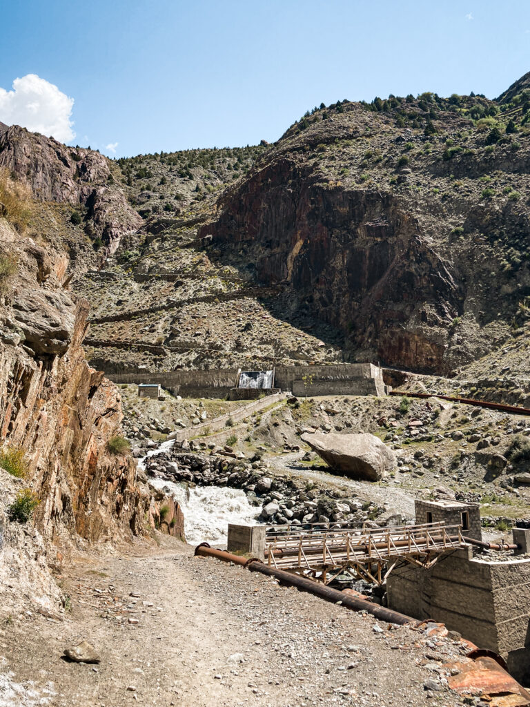
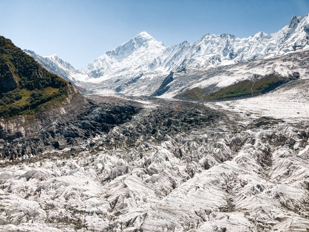
Patundas Meadows Trek
Perched high above the confluence of the Passu and Batura glaciers, Patundas Meadows (approx. 4,200 m) is one of the most spectacular, and underrated, trekking destinations in northern Pakistan. This multi-day hike offers sweeping 360-degree views of towering peaks like Passu Cones, Shispare, Ultar Sar, and even a glimpse of the mighty Batura Glacier, one of the longest glaciers outside the polar regions.
Trek Overview
Best Season: April/May to October (depends on weather)
Distance: 30 km roundtrip
Duration: 3 days (2 nights)
Elevation gain: ~2000 metres from Borith Lake to Patundas Camp One
Difficulty: Moderate to Challenging
Accommodation: Camping only
Guide? Yes! Glacier crossing is impossible to do without a guide
The trek involves crossing the dramatic Passu Glacier, camping for 2 nights with otherworldly glacier views, and retracing your steps back. It’s a relatively accessible high-altitude adventure for those with decent fitness, and it’s still off the radar for most tourists.
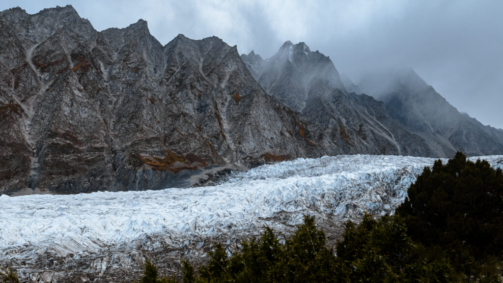 Passu Glacier
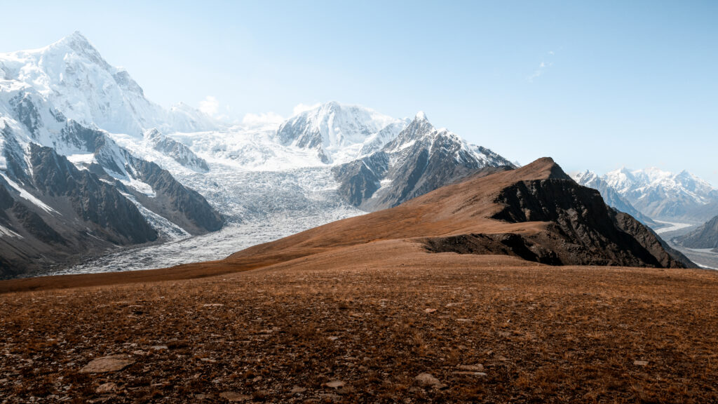 Patundas Meadows with views of both Passu and Batura Glaciers
If you’re looking for solitude, raw beauty, and a real sense of adventure – this is it. Read all the tips on how to arrange this trek in my Detailed Guide to the Patundas Meadows Trek.
Frequently Asked Questions About Trekking in Pakistan
Do you need a guide to trek in Pakistan? It depends on the trek. Most day hikes covered in this guide: Eagle’s Nest, Baskoshi Meadows, the Passu Bridges walk, Black Glacier Viewpoint, Marsur Rock, can all be done independently without any prior experience or local guidance. The Rakaposhi Base Camp trek is also doable solo if you’re a confident hiker. However, any trek that involves a glacier crossing, like Patundas Meadows, requires a local guide. Glaciers are heavily crevassed and impossible to navigate safely without someone who knows the route. The good news is you don’t need to book through a tour operator in advance, you can hire a guide directly in the nearest village, which is cheaper and more flexible.
Is trekking in Pakistan safe? Generally yes, especially for the treks listed in this guide. The main risks are altitude sickness, unpredictable weather, and remote terrain rather than anything to do with security. Always tell someone your plan before heading out, carry offline maps, and don’t push through bad weather. For a fuller picture of safety in Pakistan as an independent traveller, read my guide on solo female travel in Pakistan.
What permits do you need for trekking in Pakistan? Most independent treks in northern Pakistan don’t require advance permits. You will need to show your passport at military checkpoints, carry multiple photocopies.
What fitness level do you need? The day hikes in this guide are suitable for anyone with a reasonable level of fitness and some experience walking on uneven terrain. The multi-day treks require more preparation. You should be comfortable with full days of hiking (6-8 hours), significant elevation gain, and carrying a loaded pack. Prior trekking experience helps but isn’t mandatory for Rakaposhi Base Camp or Fairy Meadows. Patundas is more demanding and requires confidence on rough mountain terrain.
When is the best time to trek in Pakistan? May to October is the main trekking window. June to August offers the most stable weather and fully open trails. September and October are excellent: cooler temperatures, fewer people, and beautiful autumn colours in the valleys. April and early May are possible for lower-altitude hikes but some high routes may still be snowbound. Avoid trekking above 3,000m between November and April.
How do I get mobile data for trekking in Pakistan? Your regular SIM or eSIM almost certainly won’t work in Gilgit-Baltistan. Get a local SCOM SIM card from their office in Gilgit or Aliabad. It gives the best coverage along the Karakoram Highway and in most villages. Expect no signal once you’re on the trail. Download offline maps before you leave (Maps.me or Gaia GPS work well). If you want a data backup before arriving in Pakistan or for Islamabad, Saily offers Pakistan eSIMs that activate instantly. Use my code RITAHE1486 during checkout to get 5$ off!
Can I trek in Pakistan as a solo female traveller? Yes. I’ve done all the hikes in this guide solo or with other independent travellers I met on the road: no tour group, no fixed itinerary. People in the mountain communities are incredibly welcoming and used to foreign visitors. The usual sensible precautions apply: dress modestly, let someone know your plans, and trust your instincts. For more detail on travelling solo as a woman in Pakistan, read my full guide here.
Final Thoughts
Pakistan’s trekking trails are some of the best I’ve been on anywhere in the world, and almost none of them require a tour, an agency, or an expensive permit. You can organise almost everything yourself, move at your own pace, and share the mountain with almost nobody.
This guide will keep growing. I’m planning to go back and do Rush Lake, Nangma Valley, and Moses Peak among others, and I’ll add them here with the same firsthand detail once I have. In the meantime, if you have questions about any of the treks listed here (logistics, difficulty, what to bring) drop them in the comments and I’ll do my best to help.
More Pakistan Travel Guides
If you’re planning to travel Pakistan independently, these in-depth guides will help you navigate the country, travel on a budget, and explore far beyond the usual routes: