Trekking to Song-Kul Lake is one of the most rewarding ways to experience Kyrgyzstan‘s alpine landscapes and one of the least talked about. Most travellers reach this vast high-mountain lake by horse trek or 4×4, but hiking there independently is entirely possible, significantly cheaper, and gives you a far more immersive experience of the region.
Song-Kul sits at over 3,000 metres above sea level, surrounded by wide rolling pastures where nomadic herders spend their summers in traditional yurts. The lake is one of Kyrgyzstan’s most iconic destinations, but the journey there on foot: crossing mountain passes, walking through remote valleys, and staying in yurt camps along the way, is just as memorable as the destination itself.
I hiked to Song-Kul Lake independently over three days, without a guide, carrying only a light backpack and staying in yurt camps each night. This guide covers everything you need to do the same: how to reach the trailhead from Kochkor, what to expect on each day of the trail, where to stay, and how much it costs. No horse, no tour, no guide required.
The Different Ways to Reach Song-Kul Lake
Song-Kul Lake is one of Kyrgyzstan’s most famous alpine destinations, and there are several ways to get there depending on your budget, time, and travel style.
Most visitors reach the lake by horse trekking, which is a classic Kyrgyz experience and very popular among travellers. Multi-day horse treks from Kochkor usually include guides, meals, and overnight stays in traditional yurt camps along the route.
Another option is travelling by 4×4 vehicle, which allows you to reach Song-Kul in a single long day. This is the fastest and easiest way to get there, though it skips the experience of slowly entering the high mountain landscapes that make the journey so special.
For those who enjoy hiking, it’s also possible to trek to Song-Kul Lake, which is by far the most affordable option and an incredibly rewarding way to experience the region. Several trekking routes lead to the lake, crossing different valleys and mountain passes before reaching the high plateau where Song-Kul sits.
This guide focuses on the 3-day trekking route I followed, starting near the roadside before Kyzart village and forming a loop through the mountains before returning to the same area.
Song-Kul Trek Overview
Day 1: Roadside trailhead – Kyzart Pass – Kilemche Valley
Overnight in a yurt camp in Kilemche Valley.
Day 2: Kilemche Valley – Jasgis Karagai Pass (3,325 m) – Song-Kul Lake
Overnight in a yurt camp by the lake.
Day 3: Song-Kul Lake – Tuz Ashuu Pass (3,400 m) – Kyzart Village
This route crosses three mountain passes, offering sweeping views of alpine pastures, grazing horses, and distant snow-capped peaks before finally reaching the vast plateau where Song-Kul Lake lies. Staying in yurt camps along the way makes the trek far easier logistically, as you can travel with a lighter backpack while still experiencing the remote beauty of Kyrgyzstan’s nomadic landscapes.
Best Time to Trek to Song-Kul
The best time for trekking to Song-Kul Lake is between mid-June and mid-September, when the mountain passes are free of snow and the yurt camps around the lake are open for the summer season.
During these months, nomadic herders move their livestock to the high pastures surrounding Song-Kul, setting up traditional yurts and welcoming travellers for overnight stays. This is what makes the trek particularly special, as you’ll have the opportunity to experience Kyrgyzstan’s nomadic culture while crossing the alpine valleys leading to the lake.
July and August offer the most stable weather conditions, with warm days and green pastures dotted with wildflowers and grazing horses. However, even in the height of summer, temperatures can drop significantly at night due to the lake’s altitude of over 3000 metres.
Outside of this period, trekking becomes much more difficult. In spring and early summer, snow can still cover the high passes, while autumn and winter bring freezing temperatures and heavy snowfall that make the route largely inaccessible.
Preparations Before Trekking to Song-Kul
Before starting the trek to Song-Kul Lake, it’s worth taking a little time in Kochkor to prepare properly. Although the route is relatively straightforward, you’ll still be trekking through remote mountain terrain with limited facilities during the day.
A good first stop is the CBT (Community Based Tourism) office in Kochkor. The staff there are very knowledgeable about trekking routes in the area and can provide updated information about trail conditions, yurt camps, and weather forecasts. If you have any questions about the route or current conditions, this is the best place to ask before heading into the mountains.
It’s also important to check the weather forecast before starting the trek. Song-Kul sits at over 3000 metres, and conditions can change quickly. Even in summer, mornings and evenings can be cold, and storms can sometimes roll in unexpectedly.
Make sure to download offline maps on Maps.me before leaving Kochkor. Mobile reception disappears quickly once you enter the mountains, and some sections of the trail aren’t always obvious. Having the route downloaded will make navigation much easier.
Although you’ll stay in yurt camps each night where dinner and breakfast are provided, you’ll still be trekking for many hours during the day. Bring snacks and simple food for lunches. It’s also a good idea to carry a water filter or purification tablets, as you’ll be refilling from mountain streams along the route.
The temperature around Song-Kul can be surprisingly extreme. Days are often hot and exposed, especially when crossing mountain passes, but nights can be very cold due to the high altitude. Pack light clothing for hiking during the day, but also bring warm layers, a fleece or down jacket, and a hat for the evenings in the yurts.
Finally, keep in mind that Song-Kul sits at high altitude. You will reach elevations above 3300-3400 metres, which can cause mild altitude symptoms such as headaches, fatigue, or shortness of breath. Ascending gradually, staying hydrated, and taking breaks when needed will help your body adjust to the altitude.
Logistics: Getting to the Song-Kul Trailhead
Before trekking to Song-Kul Lake, you’ll first need to reach the small town of Kochkor, which acts as the main gateway to the region. From there, you can arrange transport to the trailhead where the hike begins.
Getting to Kochkor from Bishkek
The easiest way to reach Kochkor is by marshrutka (shared minibus) from Bishkek. Marshrutkas depart regularly from the city’s Western Bus Station and the journey takes around 3-4 hours, passing through wide steppe landscapes and small rural villages along the way.
Tickets are inexpensive, usually costing around 300-400 KGS, making this the most common option for independent travellers. The minibuses normally leave once they are full, so it’s best to arrive early in the morning to avoid long waiting times.
Once you arrive in Kochkor, you’ll find guesthouses, small supermarkets, and a few cafés, making it a good place to spend the night and prepare for the trek if needed.
Getting from Kochkor to the Trailhead
From Kochkor, you’ll need to arrange transport towards Kyzart village, where the trekking routes to Song-Kul begin. The drive takes around 1 to 1.5 hours through wide rural valleys and small farming communities.
The easiest option is to hire a private taxi, which can usually be arranged through your guesthouse or CBT office in Kochkor. You can try to find other travellers to share the car to split the cost. Prices generally range between 1500 and 2000 KGS per car, depending on negotiation and the season. This option allows you to be dropped directly at the start of the trail.
The cheapest option, however, is to take a marshrutka or shared taxi heading towards Kyzart village and ask the driver to drop you off at km 46 on the Kochkor-Jumgal road. The ride should cost around 300 KGS.
Once you get off the road, you won’t immediately see a clear trail or any signs pointing towards Song-Kul. For this reason, it’s important to download the Maps.me offline map in advance, as the trekking route is clearly marked there. From this roadside drop-off point, the trail gradually climbs towards the pass, marking the beginning of the trek to Song-Kul Lake.
Staying Connected
Mobile signal is unreliable in the area, so having the trail downloaded on your phone will help you find the correct path and avoid getting lost. This makes downloading your Maps.me or Gaia GPS data before you leave Kochkor non-negotiable.
To ensure I had high-speed data to sync my maps and check the mountain weather forecast before heading out, I used a Saily eSIM. It’s much more convenient than hunting for a local SIM card in Bishkek, allowing you to activate your Kyrgyzstan data plan the moment you land so you can focus on the trail instead of the tech.
Need data before you land? Try Saily eSIM
Use code RITAHE1486 for $5 off your first plan.
Don’t Forget: High-Altitude Travel Insurance
Trekking to Song-Kul takes you above 3,000 meters, an altitude where many standard travel insurance plans stop providing coverage.
I personally use and recommend SafetyWing for trekking in Kyrgyzstan. Their Nomad Insurance specifically covers “hiking up to 4,500 meters” in their standard policy, which is exactly what you need for Song-Kul It’s a small price to pay for the peace of mind that you’re covered for emergency evacuation in the mountains.
Don’t skip travel insurance!
I use SafetyWing for most trips – solid coverage for adventure travel.
How Much Does the Song-Kul Trek Cost?
One of the best things about trekking to Song-Kul independently is how affordable it is compared to joining an organised horse trek or 4×4 tour. Here’s a realistic breakdown of what to budget for the full three days.
| Expense | Approximate Cost |
|---|---|
| Marshrutka Bishkek → Kochkor | 300-400 KGS |
| Marshrutka Kochkor → Trailhead | 300 KGS |
| Taxi Kochkor → Trailhead (per car) | 1,500-2,000 KGS |
| Yurt camp per night (dinner + breakfast) | 1,600-2,000+ KGS |
| Snacks and lunch food (per day) | 200-400 KGS |
| Taxi or hitchhike back from Kyzart | 500-2,000 KGS |
| Total (solo, 3 days) | ~4,600-9,000 KGS |
Yurt camp prices were around 1,600 KGS per night in 2022 and have likely increased since. It’s worth confirming current rates with the CBT office in Kochkor before you leave, as prices can vary between camps and seasons.
There are no permit fees for this route. Food and accommodation on the trail itself is covered by the yurt camp stays, so your main out-of-pocket expense during the trek is snacks and anything you pick up in Kochkor beforehand.
Money-Saving Tips for the Trail
Avoid ATM fees with Wise
The card I use for all my travel withdrawals – real exchange rate, low fees.
Use Revolut to avoid ATM fees
Good alternative to Wise – I carry both as a backup.
3-Day Trekking Itinerary to Song-Kul Lake
This three-day trek to Song-Kul Lake follows a scenic route from the Kyzart region, crossing several mountain passes before reaching the vast alpine plateau where the lake lies. The trail passes through sweeping valleys, high pastures filled with grazing horses, and remote nomadic settlements where you’ll spend the nights in traditional yurt camps.
Although the distances are manageable, each day involves steady climbs over mountain passes, so expect long hours of hiking. The reward is a constantly changing landscape and the chance to experience Kyrgyzstan’s nomadic culture along the way.
Trek Overview
Best Season: July to September (depends on weather)
Starting Point: Roadside trailhead on the Kochkor-Jumgal road
Ending Point: Kyzart Village
Distance: ~ 50 km
Duration: 3 days (2 nights)
Altitude: Max ~ 3400 meters
Total Elevation gain: ~ +1800
Difficulty: Moderate
Navigation: Trails are not always marked – offline maps recommended
Accommodation: Yurt Camps in Kilemche Valley and Song-Kul Lake
Guide? Not Mandatory, but recommended if you’re not an experienced trekker
Day 1: Roadside Trailhead – Kyzart Pass – Kilemche Valley
The trek begins shortly after leaving the Kochkor–Jumgal road, where a faint shepherd trail gradually climbs into the surrounding hills. At first, the path winds through dry grassy slopes, with wide views opening up across the valley below.
The ascent towards Kyzart Pass is steady but not overly steep, making for a good introduction to the trek. As you gain elevation, the landscape becomes greener, with rolling alpine pastures stretching in every direction. Horses, sheep, and cows graze freely across the hills, watched over by shepherds living in nearby yurts.
After crossing the pass, the trail descends gently into Kilemche Valley. Before you enter the valley, you’ll encounter a small river crossing. Be careful here, especially if the snowmelt is high, water levels can rise and certain sections may be deceptively deep. Take your time and test footing carefully to avoid slipping.
Kilemche is one of the most picturesque valleys in the region, with herds of horses wandering across the pastures and the occasional shepherd riding through the valley. Most trekkers spend the night here in one of the yurt camps, where you’ll be welcomed with a hot meal and a place to sleep after the first day on the trail.
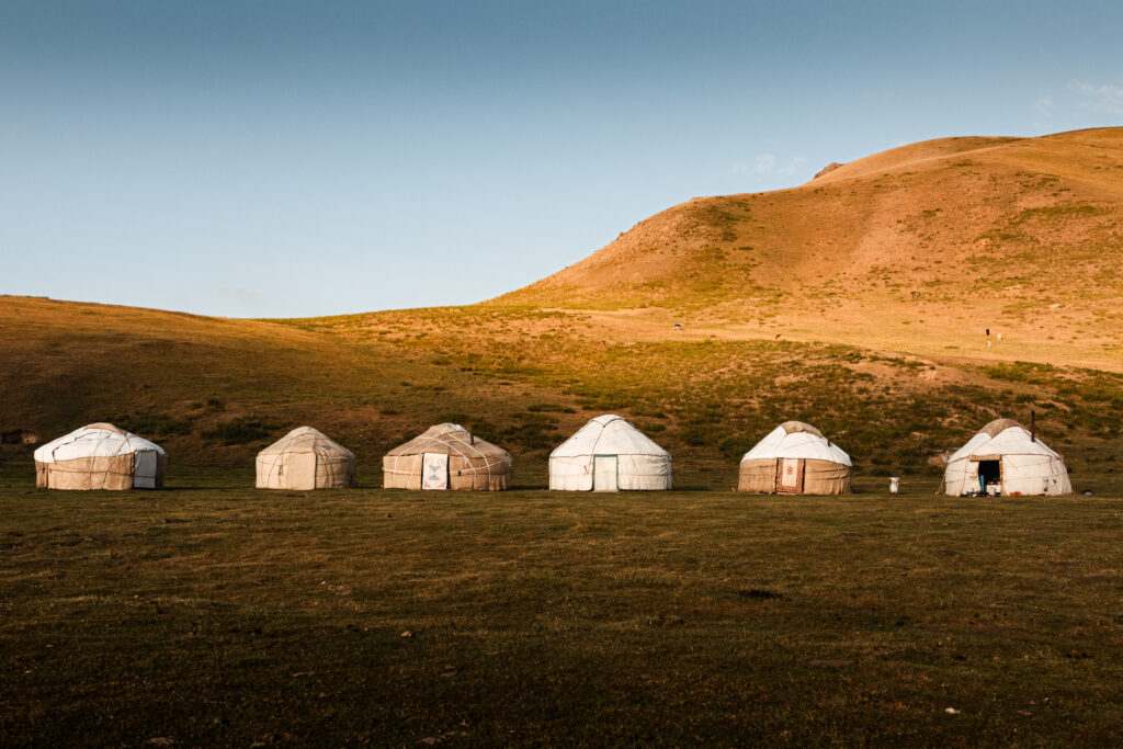 Yurt Camp at Kilemche Valley
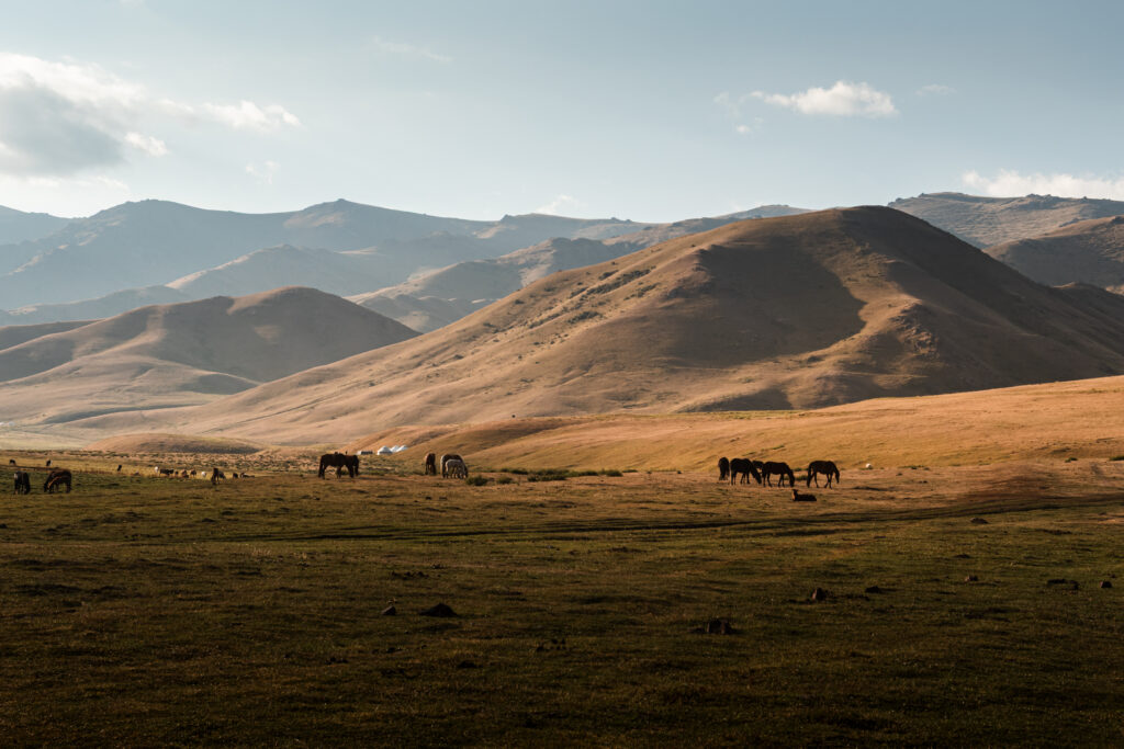 Views from the Yurt Camp at Kilemche Valley
Day 2: Kilemche Valley – Jasgis Karagai Pass (3325 m) – Song-Kul Lake
Day two is the most spectacular part of the trek, as you climb over the highest pass of the route before reaching Song-Kul Lake. Leaving Kilemche behind, the trail begins a long, gradual ascent towards Jasgis Karagai Pass, climbing through open alpine meadows. The higher you go, the more dramatic the scenery becomes, with wide mountain panoramas stretching across the landscape.
 Views of the lake from Jasgis Karagai Pass at 3325 meters
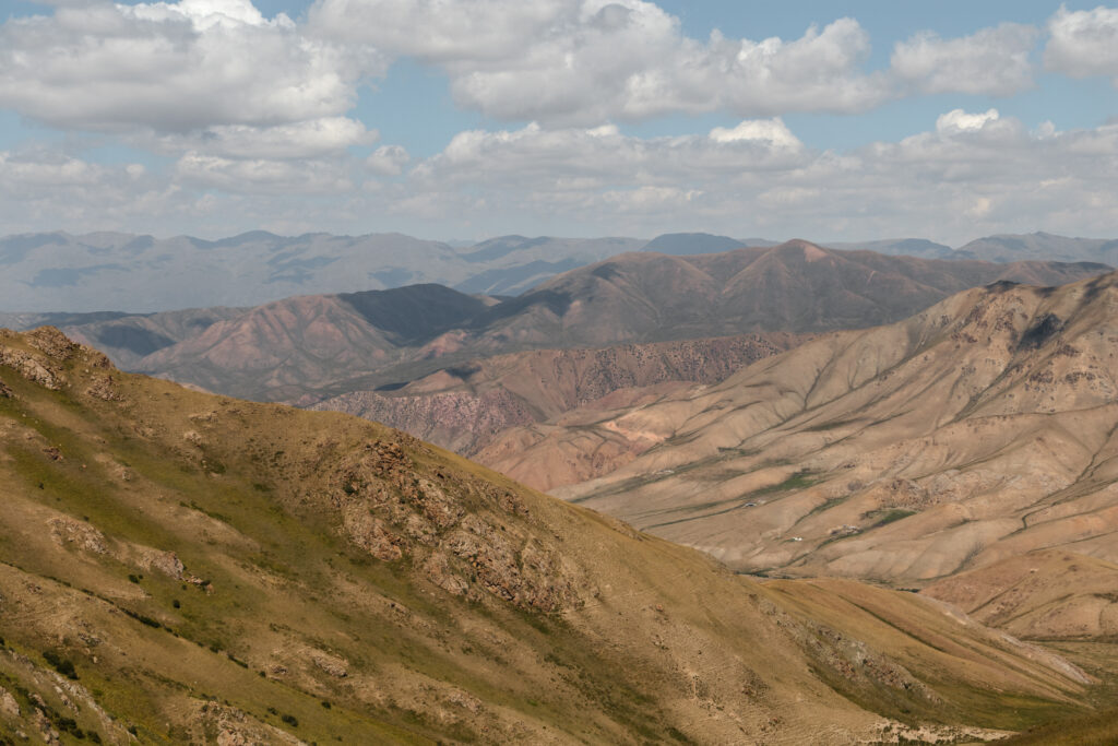 Views over Kilemche from Jasgis Karagai Pass at 3325 meters
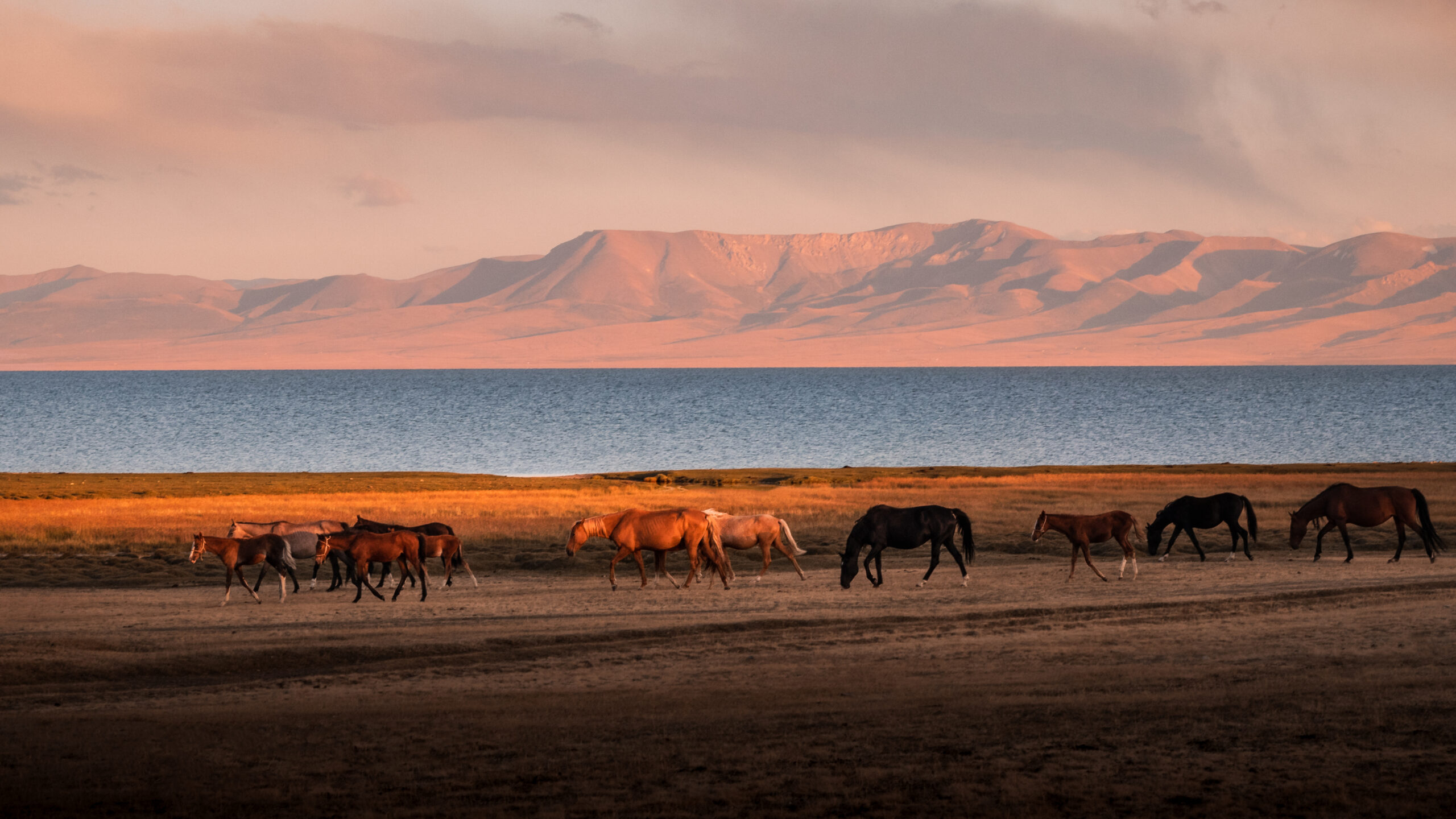
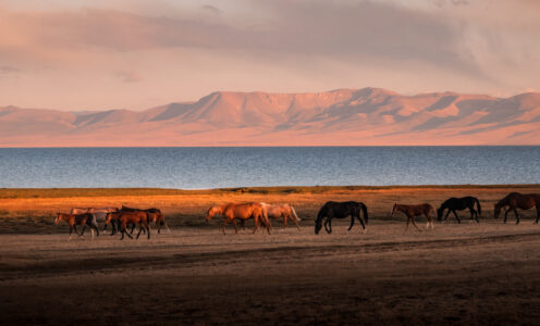
The final approach to the pass is steeper, but once you reach the top at 3325 metres, you’ll be rewarded with your first glimpse of Song-Kul Lake in the distance. The vast blue lake sits in the middle of a high plateau surrounded by rolling mountains, creating one of the most iconic landscapes in Kyrgyzstan. From the pass, the trail descends slowly towards the lake, passing more summer pastures and nomadic camps along the way. As you get closer, the enormous scale of Song-Kul becomes more apparent.
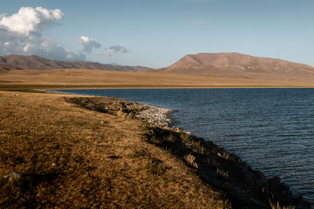 Shores of Song-Kul
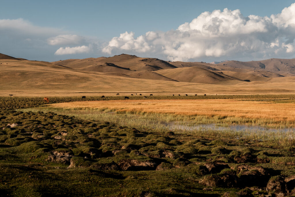 Horses grazing by the shores of Song-Kul
By late afternoon, you’ll reach one of the yurt camps along the lakeshore, where you’ll spend the night. After a long day of hiking, sitting down for a warm meal while watching the sunset over the lake is one of the highlights of the trek.
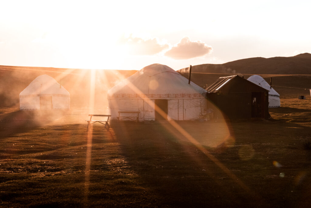 Yurt Camp at sunset by Song-Kul
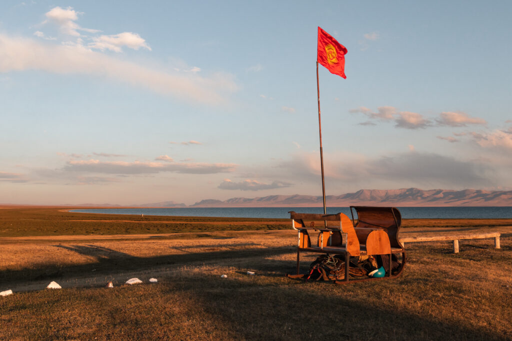 Views of Song-Kul from the Yurt Camp
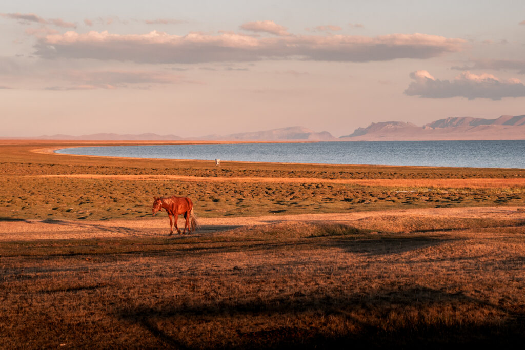 Horse Grazing at Song-Kul at sunset
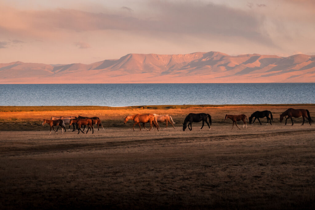 Horses at Song-Kul at sunset
Day 3: Song-Kul Lake – Tuz Ashuu Pass (3400 m) – Kyzart Village
The final day begins by leaving the shores of Song-Kul and heading towards Tuz Ashuu Pass, the last mountain pass of the trek.
The climb is steady but manageable, gradually gaining altitude as you leave the lake behind. Looking back along the trail, you’ll have beautiful views of Song-Kul’s vast waters, with herds of horses grazing along the shoreline.
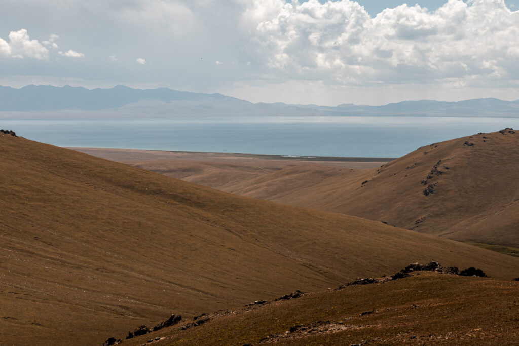
At around 3400 metres, Tuz Ashuu Pass offers sweeping views across the surrounding mountain ranges and valleys. From here, the trail begins a long descent towards Kyzart village, winding down through grassy hills and shepherd trails.
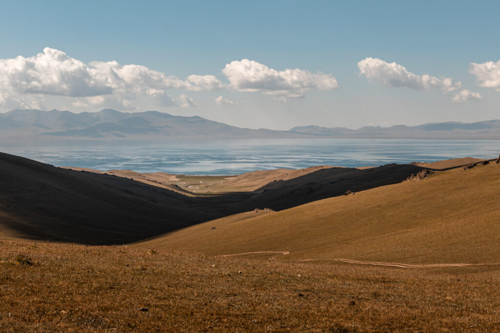 Views of the lake from Tuz Ashuu Pass at 3400m
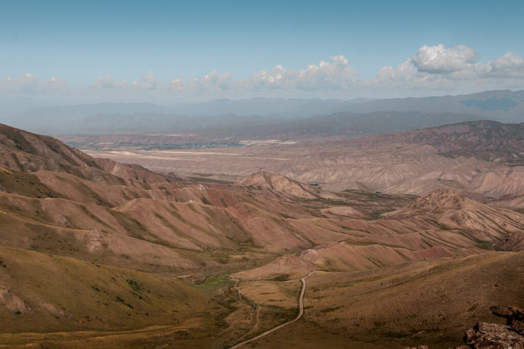 Views of Kyzart village from Tuz Ashuu Pass
As you descend further, signs of village life slowly reappear, small farms, grazing animals, and dirt roads leading back towards civilisation. Eventually the trail connects with the road near Kyzart, marking the end of the trek. If you don’t feel like walking on the dusty road the last km to Kyzart Village, I’d recommend you to hitchhike there instead.
Can You Do the Song-Kul Trek Without a Guide?
Yes. The Song-Kul trek can be done independently, but there are some important considerations to keep in mind. The route I followed is straightforward, and with proper preparation, independent trekking is entirely feasible for hikers with basic experience and a reasonable level of fitness.
Most of the trail is visible as shepherd paths across alpine pastures, and you’ll often see grazing horses or distant yurts, which make navigation easier. However, the trail is not always clearly marked, so having offline maps on your phone (such as Maps.me) is essential to avoid getting lost.
Staying in yurt camps each night also makes the trek more manageable. You don’t need to carry heavy camping gear or cook your own meals, but you should bring snacks, a water filter, and layers for changing weather. Days can be hot in the sun, but nights are cold at high altitude, and the trek crosses elevations above 3000 metres, so some level of acclimatisation is helpful.
That said, if you are not confident navigating mountain trails, unsure about high-altitude trekking, or uncomfortable navigating by yourself, hiring a local guide or joining a small trekking group is a safer option. Guides can provide route knowledge, help carry luggage, and assist with any unexpected challenges, making the experience smoother and more reassuring.
In short, independent trekking to Song-Kul is possible for prepared hikers who are comfortable with basic navigation and self-sufficiency. For those less experienced or looking for extra support, a guide can make the journey safer and more enjoyable.
Frequently Asked Questions About the Song-Kul Trek
How difficult is the Song-Kul Lake trek? The Song-Kul trek is moderate in difficulty. The daily distances are manageable and the terrain is mostly open alpine pasture rather than technical mountain trail, but each day involves a steady climb over a mountain pass. The longest day is the final one at around 23km. A reasonable level of fitness is enough: you don’t need prior trekking experience, but you should be comfortable walking for 6-8 hours a day.
How long does it take to trek to Song-Kul Lake? This route takes three days, covering roughly 50km in total and crossing three mountain passes. It’s possible to do a shorter two-day version depending on your fitness and starting point, but three days gives you more time to enjoy the landscape and spend a proper night at the lake.
Do I need a permit to trek to Song-Kul Lake? No permit is required for this trek. You can start the route directly from the roadside trailhead near Kochkor without any registration or fees. Stopping by the CBT office in Kochkor before you leave is still recommended for updated trail and weather information, but it’s not mandatory.
How much does the Song-Kul trek cost? The trek is one of the most affordable ways to experience Kyrgyzstan’s highlands. The main costs are transport from Bishkek to Kochkor, a taxi to the trailhead, and yurt camp accommodation each night. See the full budget breakdown in the costs section above.
Can I do the Song-Kul trek without a guide? Yes, with the right preparation. The trail follows shepherd paths across open pastures and is straightforward to navigate with offline maps downloaded on your phone: Maps.me shows the route clearly. If you’re comfortable with basic navigation and mountain conditions, a guide is not necessary. If you’re new to trekking or unsure about high-altitude hiking, hiring a local guide through CBT Kochkor is a good option.
When is the best time to trek to Song-Kul Lake? The trek is accessible between mid-June and mid-September, when the mountain passes are snow-free and the yurt camps are open. July and August offer the most stable weather, but even in peak summer temperatures drop sharply at night due to the altitude. Outside of this window, snow on the passes makes the route much harder or impassable.
What should I pack for the Song-Kul trek? You don’t need to carry camping gear since you’ll sleep in yurt camps each night. The essentials are: offline maps downloaded before you leave, a water filter or purification tablets for refilling from streams, snacks and lunch food for the trail, warm layers and a jacket for cold nights, and sun protection for the exposed mountain passes. Trekking poles are useful but not essential.
Explore More of Kyrgyzstan
If you enjoyed trekking to Song-Kul Lake, there are plenty more wild and beautiful places to discover in Kyrgyzstan. From remote alpine lakes to high valleys and charming towns, the country offers countless opportunities for adventure and independent travel. Check out some of my other Kyrgyzstan guides: