Carved into the spine of the world’s highest mountain ranges, the Karakoram Highway (KKH) is one of the most spectacular roads on Earth. In this guide, I’ll share how to travel the Karakoram Highway using public transport and hitchhiking, the most iconic stops to make along the way, and practical tips to help you navigate one of the world’s greatest road trips – on local buses, shared jeeps, and the occasional crammed vans.
Winding its way from the lush plains of northern Pakistan to the towering peaks of the Karakoram and up to the Chinese border at Khunjerab Pass, this legendary route follows an ancient path once trodden by Silk Road traders.
More than just an engineering marvel, the KKH offers an unforgettable journey through remote valleys, glacier-carved landscapes, and vibrant mountain communities steeped in tradition. Travelling it independently adds a raw sense of adventure, with each stop revealing Pakistan’s rugged beauty and warmth.
What is the Karakoram Highway?
Often dubbed the “Eighth Wonder of the World,” the Karakoram Highway is the highest paved international road on the planet. Stretching over 1,300 kilometres, it connects the city of Hasan Abdal near Islamabad to Kashgar in China, crossing through the dramatic mountains of northern Pakistan and the Khunjerab Pass at an altitude of 4,693 metres.
Built jointly by Pakistan and China between the 1960s and 1970s, the highway is not only a feat of engineering but also a symbol of cross-border cooperation and a modern echo of the ancient Silk Road. Along the way, it cuts through three of the world’s greatest mountain ranges: the Himalayas, the Hindu Kush, and the Karakoram.
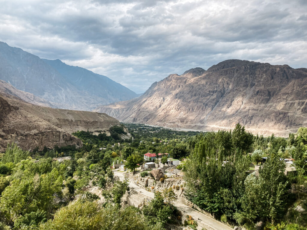
Travellers on the KKH are treated to an ever-changing landscape of snow-capped peaks, turquoise rivers, hanging glaciers, and vibrant villages, with every bend in the road offering a new perspective. The route also serves as the main access point to some of Pakistan’s most iconic destinations, including Hunza Valley, Gilgit, and the Khunjerab Pass.
The KKH is open year-round up to Sost, but the section beyond leading to the Khunjerab Pass and the Chinese border is typically closed during winter months (November to April) due to heavy snowfall. The best time to travel is from May to October, when the weather is mild and the views are the most breathtaking.
How to Travel the KKH by Public Transport
Types of Transport
NATCO Buses: The Northern Areas Transport Corporation runs reliable long-distance buses, especially from Rawalpindi/Islamabad to Gilgit and Aliabad, and onwards to Sost and the Khunjerab Pass. It’s a good option for longer legs of the trip.
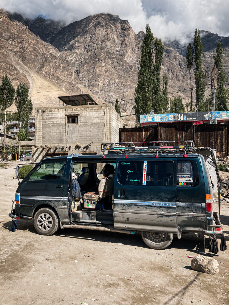
Minibuses: These are the most common way to get between towns. There are no schedules, they leave when full and are cheap, fast, and somewhat frequent on popular routes like Gilgit to Hunza.
Vans and Shared Jeeps: Often used for short, local hops, especially between villages or for detours off the main highway. Expect to squeeze in with locals and luggage.
Hitchhiking: In the most popular areas, like Hunza, it’s incredibly easy to hitchhike. I felt very safe, even as a solo female traveller, but always trust your instincts.
Where to Catch Transport
Rawalpindi (Pir Wadhai Bus Terminal): Major departure point for buses and shared taxis heading north. This is the location of the NATCO office where to can purchase your tickets.
Gilgit: This is the location of the main transit hub in Gilgit, with minibuses, NATCO counters, and shared vans going in every direction (like Islamabad, Skardu, Fairy Meadows, etc). There’s also this other location for local vans heading north to Aliabad and so on. So depending where you’re going you might need to go to a different location. Ask previously in your hotel or to the locals to be sure.
Aliabad (Hunza): There’s one location for the local vans heading north towards Passu and Sost and another for the ones heading south back to Gilgit. Once again everyone is very helpful so just ask the locals for directions. This is the location of the one that goes north.
 Local Minibus
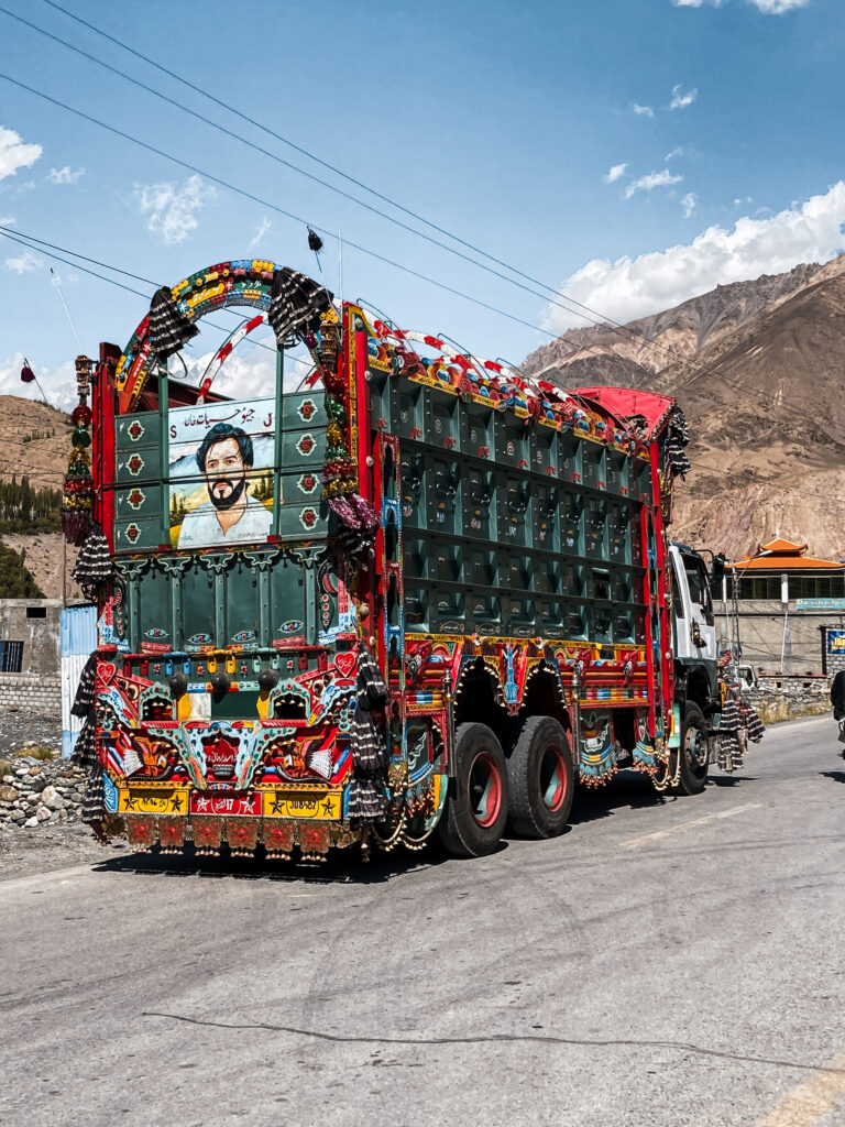 Pakistani Truck
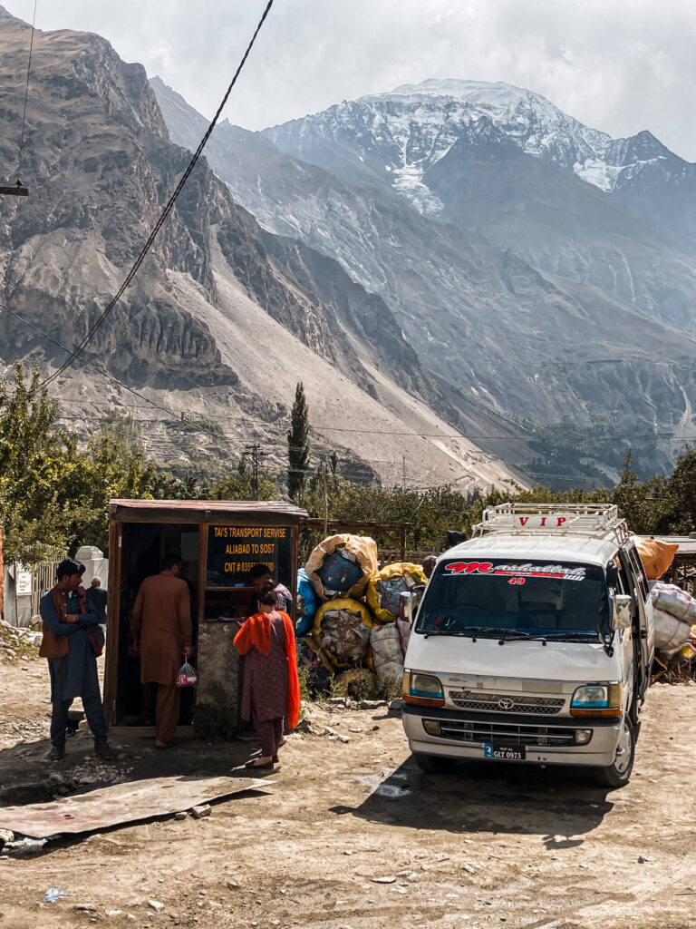 Local Minibus Station
Practical Tips for Travelling the Karakoram Highway
Getting Cash
Cash is essential when travelling the Karakoram Highway and ATMs that take foreign cards don’t exist outside the major towns of Islamabad, Gilgit, Aliabad and Skardu. It’s best to withdraw a large amount of Pakistani Rupees in these major cities before heading to more remote areas. Also sometimes the ATMs even in larger towns can run out of cash or be temporarily offline, so don’t rely solely on them. I tried a few different banks but the the only one that would work to withdraw money was Bank Alfalah.
Internet and Mobile Data
Wi-Fi access along the Karakoram Highway is generally limited and mostly found in hotels, guesthouses, and some cafes in larger towns like Islamabad, Gilgit, and Karimabad. In smaller villages and remote areas, internet connectivity is often weak or non-existent, so don’t rely on Wi-Fi for staying connected. And keep in mind that even in places with Wi-Fi speeds can be slow and unreliable.
Therefore, it’s best to get a local SIM card with a data plan. Regarding mobile connectivity, you’ll need to purchase a local SIM card in Gilgit as the ones that work in Islamabad won’t work very well here. I’d recommend SCOM (office in Gilgit) for the best coverage along the KKH but the signal strength can vary in more remote valleys. Data packages are pretty affordable and convenient. I paid a total of 1100 PKR (around 3.5€) for the SIM card and data plan of 20GB for 1 month.
Other Tips for Travelling the KKH by Public Transport
How to Reach the Karakoram Highway
From Lahore
If you’re arriving in Pakistan via Lahore and plan to travel north, your first stop will be Islamabad. Getting there is straightforward, with frequent departures throughout the day. Several bus companies operate this route from Lahore, offering a range of comfort levels. You can find the bus companies on this road in Lahore and I recommend Faisal Movers. The journey takes around 5 hours and typically costs around 1,500 PKR, depending on the company and the type of bus you choose.
What to Do in Lahore
If you have an extra day before heading north, spending it in Lahore is well worth it. Pakistan’s cultural capital is intense, chaotic, and full of history, offering a striking contrast to the mountain landscapes that lie ahead. Wander through the narrow streets of the old city, where everyday life unfolds among centuries-old buildings, then visit Badshahi Mosque and the neighbouring Lahore Fort, two of the city’s most impressive Mughal-era landmarks.
In the evening, head to Food Street to try classic Punjabi dishes like karahi, biryani, and freshly baked naan while soaking up the atmosphere. If you’re curious and have the time, you can also watch the Wagah Border ceremony, though it’s optional and more of a spectacle than a cultural essential. Use ride-hailing apps like inDrive to get around the city in an easy, convenient way without having to haggle with taxi drivers.
Where to Stay in Lahore
Lahore is a huge city with accommodation options for every budget and travel style. Budget travellers will find a few hostels and simple guesthouses around the old city, such as Lahore Backpackers, which is a convenient base if you want to explore historical sights and Food Street on foot. If you’re after more comfort, better cafés, and a quieter atmosphere, head to newer neighbourhoods like Gulberg, where you’ll find plenty of mid-range and upscale hotels.
From Islamabad
Islamabad is the capital of Pakistan and the main jumping-off point for anyone heading north along the Karakoram Highway. Clean, green, and surprisingly modern, it offers a soft landing into the country before the wild mountain roads begin, but it doesn’t fully reflect what most people imagine a Pakistani city to be.
You can spend time visiting highlights like the Faisal Mosque or walking in the Margalla Hills National Park. However, for a taste of real Pakistani city life, it’s worth crossing over to nearby Rawalpindi. Chaotic, loud, and full of life, Rawalpindi offers bustling bazaars, street food, and a glimpse into everyday urban Pakistan. Use ride-hailing apps like inDrive to get around the city in an easy, convenient way without having to haggle with taxi drivers.
Where to Stay and Eat in Islamabad
Islamabad has a good range of budget guesthouses and hostels. On my first trip, I stayed at the popular Backpackers Hostel Islamabad, but at the time I found the surrounding area a bit uncomfortable as a solo female traveller. On my most recent visit, however, my favourite area to stay has been F-7 Sector, especially close to F-7 Markaz. It’s a much more pleasant neighbourhood where you can easily walk around, find plenty of food options, cafés, and shops, and much closer to major sights like the Faisal Mosque.
When it comes to food, Islamabad has some excellent options. In F-7, I highly recommend Kabul Restaurant, an Afghan restaurant serving delicious dishes like Afghan BBQ and qabili pulao. For something more casual, Quetta Chai is a local favourite with different teas and some of the best parathas I’ve had anywhere in Pakistan. If you have a sweet tooth, don’t miss Crumble Cookies, which has several branches in Islamabad, Rawalpindi, and Lahore and serves incredible warm cookies. As the capital, Islamabad is also one of the easiest places in Pakistan to find Western-style cafés, coffee shops, and international restaurants if you’re craving a break from local food.
Stocking Up Before You Go
Getting from Islamabad to the KKH
Most travellers heading north take a long-haul bus to Gilgit, the first major hub along the KKH. The journey takes around 18-20 hours and passes through the dramatic Babusar Pass or the longer, lower-altitude route via Besham and Chilas. The bus cost 5000 PKR (around 16€).
You can also opt for a shared taxi – it’s a bit more expensive but significantly faster (around 12 hours). Just keep in mind that it’s much harder to get any sleep. The shared taxi will cost 6000 PKR (back seat) and 10000 PKR (front seat).
From Skardu
You can also choose to fly from Lahore or Islamabad directly to Skardu to save time and avoid a long road journey. Flying to Skardu is generally more reliable than flying to Gilgit, as flights to Gilgit are cancelled very frequently. If you’re looking for ideas on what to do in Skardu and practical tips for visiting the region, check out my detailed guide to Skardu & nearby valleys.
From Skardu, reaching the Karakoram Highway is straightforward. There are plenty of minibuses and shared cars running between Skardu and Gilgit. Simply head to the main transport station and choose whichever option suits you best. There are no fixed schedules, vehicles usually depart once full, so it’s best to arrive in the morning. The journey typically takes around 8-10 hours by bus and 5-6 hours by shared-car, depending on road and weather conditions.
Iconic Stops Along the Karakoram Highway
Gilgit: The Gateway to the North
Gilgit is the unofficial capital of Gilgit-Baltistan and a major hub for anyone travelling along the KKH. While the town itself isn’t the most exciting destination, it’s an essential stop for organising transport and resting after the long journey from Islamabad or Skardu.
Transport Hub:
From Gilgit, you can catch minibuses, shared taxis, and jeeps to all the iconic destinations along the KKH and beyond – Hunza, Passu, Sost, and even places like Fairy Meadows (via Raikot Bridge).
Things to Do in Gilgit
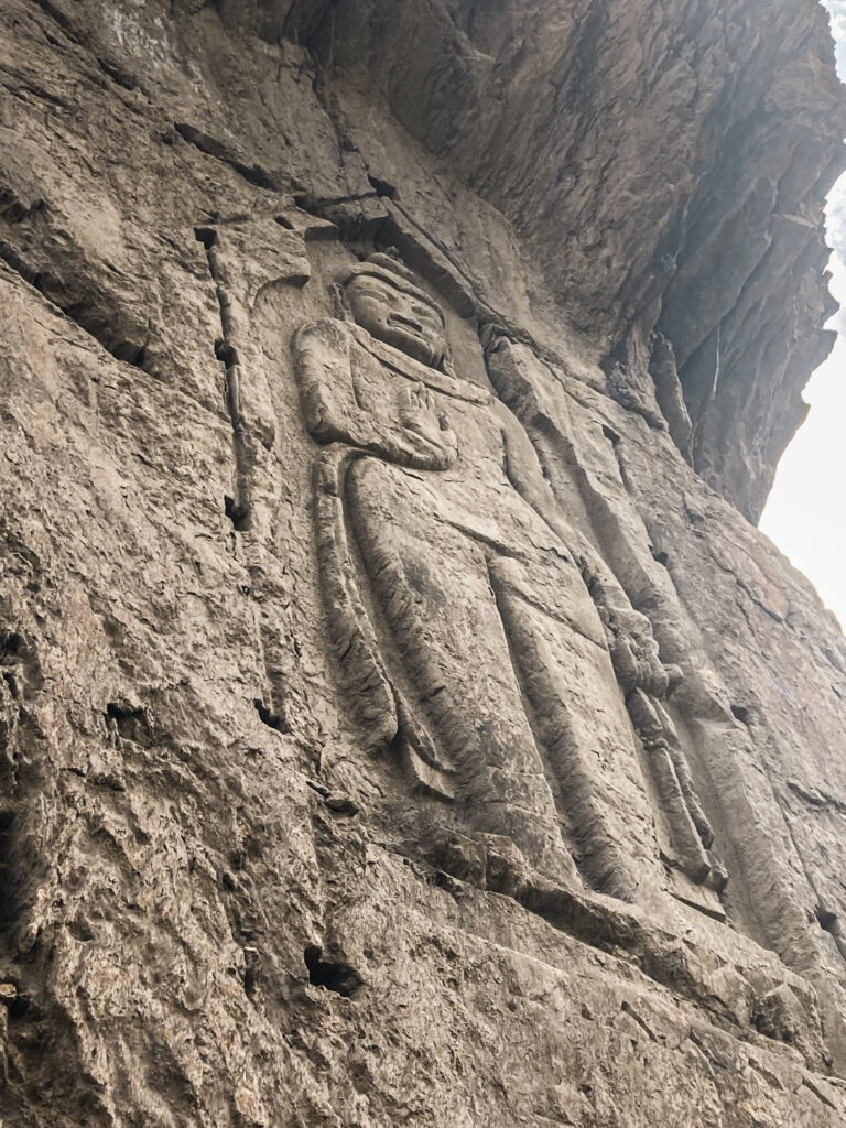
If you spend a night in Gilgit, there are a few low-key but worthwhile things to check out. Just outside town, the Kargah Buddha, an ancient rock carving dating back to the 7th century, sits tucked into a dramatic cliffside and makes for a quick cultural stop. Within the town itself, a stroll along the Gilgit River is a peaceful way to unwind, especially around sunset. You can also explore the local bazaar, where you’ll find everything and can get snacks, fresh fruits and some basic trekking supplies.
Where to Stay in Gilgit
Gilgit is the main transport hub of Gilgit-Baltistan and a convenient base before heading further along the Karakoram Highway. While it’s not the most scenic town in the region, it has a decent selection of budget guesthouses and mid-range hotels, plus plenty of small eateries within walking distance.
For budget travellers, there are several simple guesthouses near the bus stand and along the main road. Rooms are usually basic, with private bathrooms and hot water available in the evenings.
When I was in Gilgit I stayed at Madina Hotel, which is one of the most popular stops for backpackers and budget travellers. It’s more on the expensive-ish side for Pakistan at around 4500 PKR (15€) for a double room, but it has a nice courtyard to relax and escape the bustling chaos of the city.
Detours from the KKH: Side Trips from Gilgit
While the Karakoram Highway itself is legendary, some of the most unforgettable places lie just a short detour away from it and Gilgit is the perfect jumping-off point.
Fairy Meadows
One of Pakistan’s most famous trekking spots, Fairy Meadows offers stunning views of Nanga Parbat (8126 meters), the world’s ninth-highest mountain. To get there, take a shared van from Gilgit to Raikot Bridge which costs 500 PKR (around 1.64€). There you’ll transfer to a local jeep. Hold on tight – it’s one of the most dangerous roads in the world. The jeep has a fixed price but you can try to share with other travellers so it becomes cheaper.
After the a hot and bumpy ride, it’s a 2-3 hour uphill hike to reach the meadows, where you’ll find basic cabins, tents, and panoramic alpine scenery straight out of a dream.
Note: Fairy Meadows is usually accessible from mid-May to October, depending on weather conditions. For more information on how to get there, where to stay, and trekking details check out my Ultimate Guide to Trekking in Pakistan.
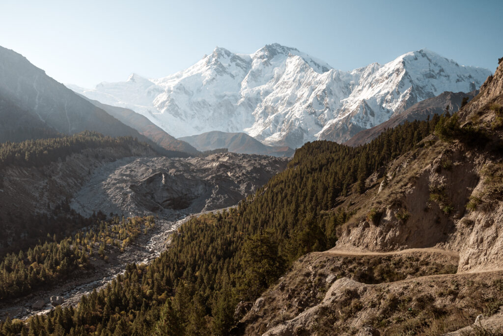 Trekking with views of Nanga Parbat (8126 meters)
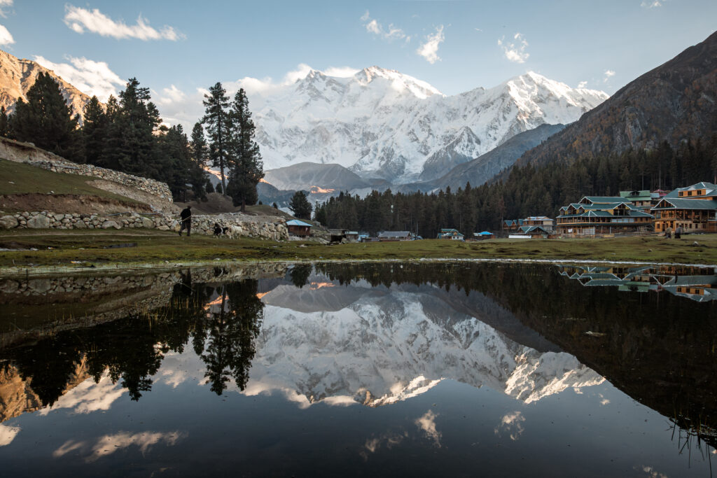 Fairy Meadows with the reflection of Nanga Parbat
Naltar Valley
Just outside Gilgit, Naltar Valley makes for a rewarding detour from the Karakoram Highway. Known for its alpine landscapes, pine forests, and striking turquoise lakes, Naltar feels worlds away from the dusty highway below. Reaching the valley is part of the adventure: the rough jeep track from Gilgit takes around 2-3 hours. Once there, you’ll find cool mountain air, simple guesthouses, short hikes, and a slower pace that’s perfect for a night or two. If you have extra time while passing through Gilgit, Naltar is one of the easiest and most scenic side trips in the region. Here you can find the shared-jeeps going towards Naltar Valley. For more information on Naltar Valley and other detours to remote valleys check this post.
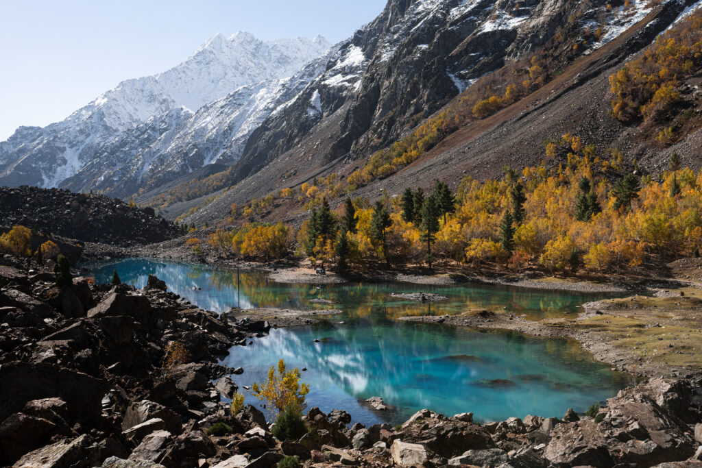 Blue Lake in Naltar Valley in Autumn
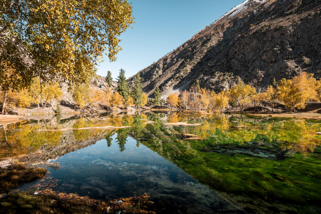 Green Lake in Naltar Valley in Autumn
Hunza Valley: The Crown Jewel of the KKH
No journey along the Karakoram Highway is complete without a stop in the legendary Hunza Valley. Framed by dramatic peaks and glacial rivers, this high-altitude region is not only visually stunning but also rich in history, culture, and warm hospitality. Whether you’re here for trekking, photography, or simply to slow down and soak in the views, Hunza never disappoints.
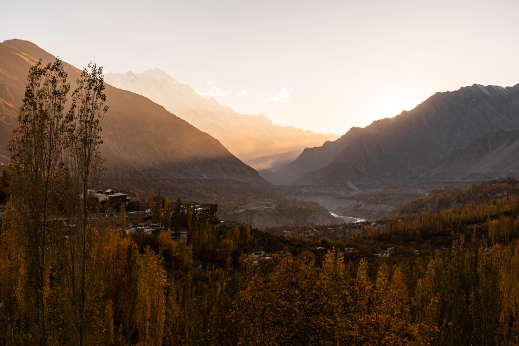 Hunza Valley at Sunset in Autumn
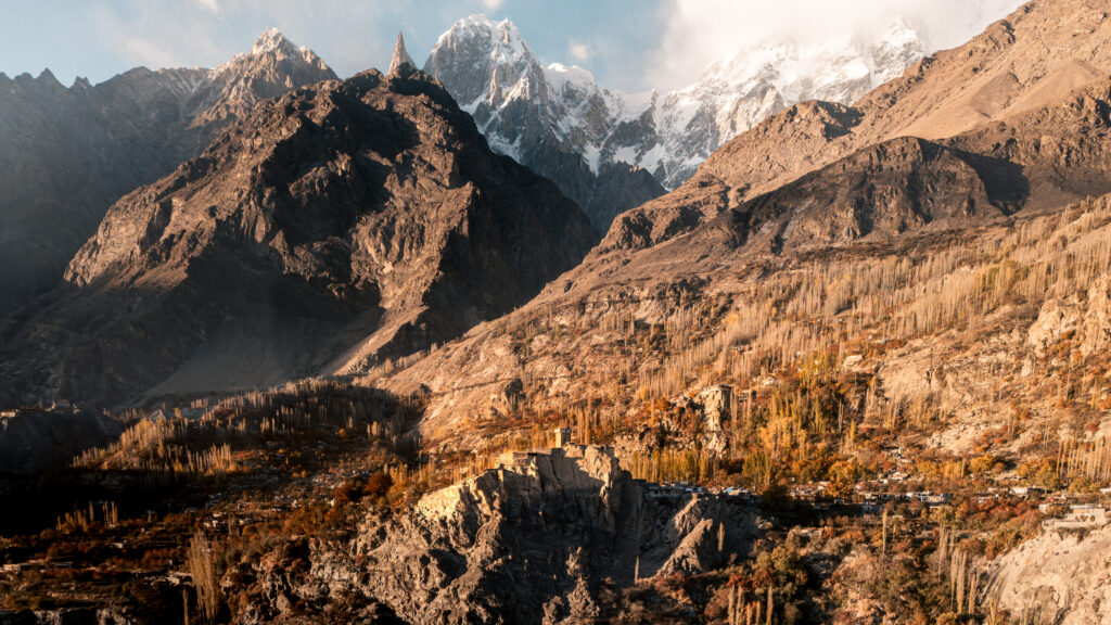 Altit Fort in Hunza Valley in Autumn
Minapin and the Rakaposhi Basecamp Trek
Just before reaching central Hunza, a small road branches off the KKH toward Minapin, a peaceful village nestled in the Nagar Valley. While it’s often overlooked by those rushing toward Karimabad, Minapin is a hidden gem, especially for trekkers. This is the starting point for the Rakaposhi Basecamp trek, one of the most accessible multi-day hikes in the Karakoram region.
Rakaposhi towers at 7,788 metres, making it the 27th highest mountain in the world. The trek to its basecamp at around 3400 metres offers unbeatable views of Rakaposhi’s icy southern face, one of the tallest mountain walls in the world rising over 5000 vertical metres from base to summit.
The trail begins directly from Minapin and climbs steadily through a shady forest of pine and juniper before opening into alpine meadows. Most hikers spend 1 night camping at Hapakun Campsite. The hike is considered moderate in difficulty, with a round trip of approximately 20-24 km and an elevation gain of around 1500 metres.
For more information on how to get there, where to stay, and trekking details check out my article Ultimate Guide to Trekking in Pakistan.
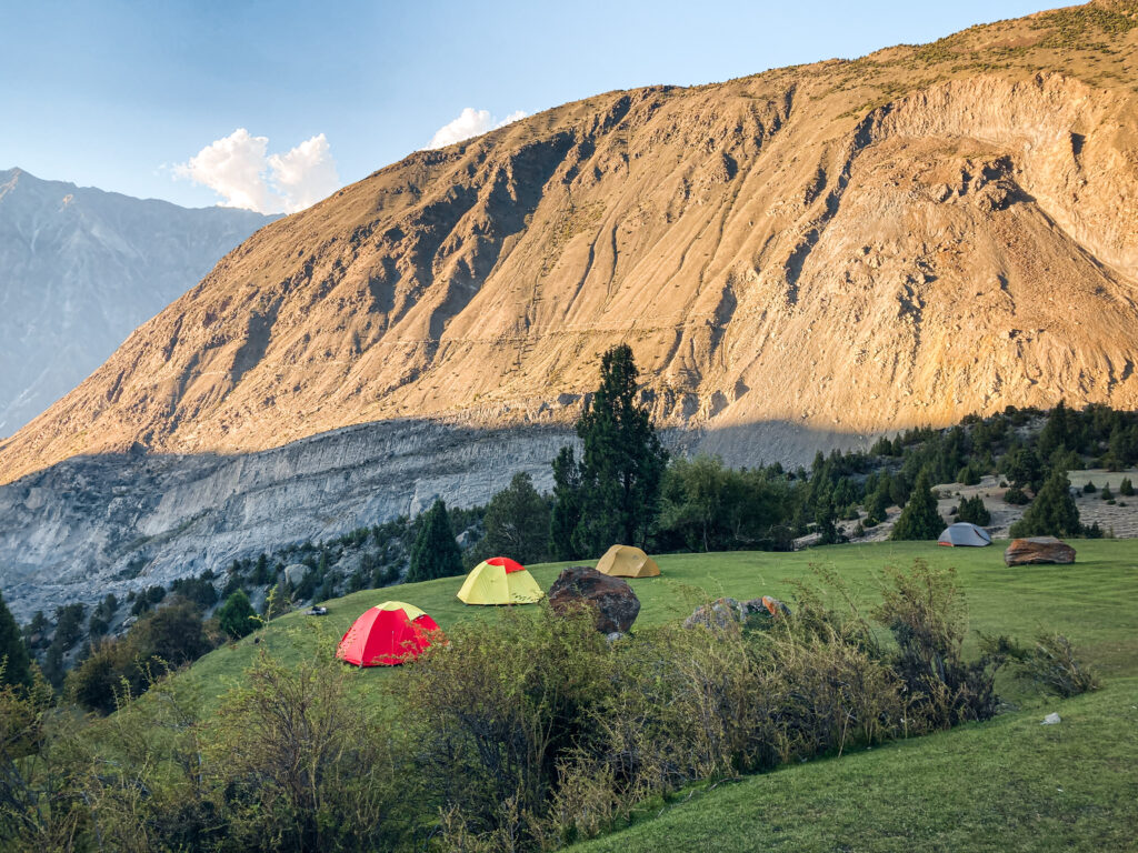 Hapakun Campsite
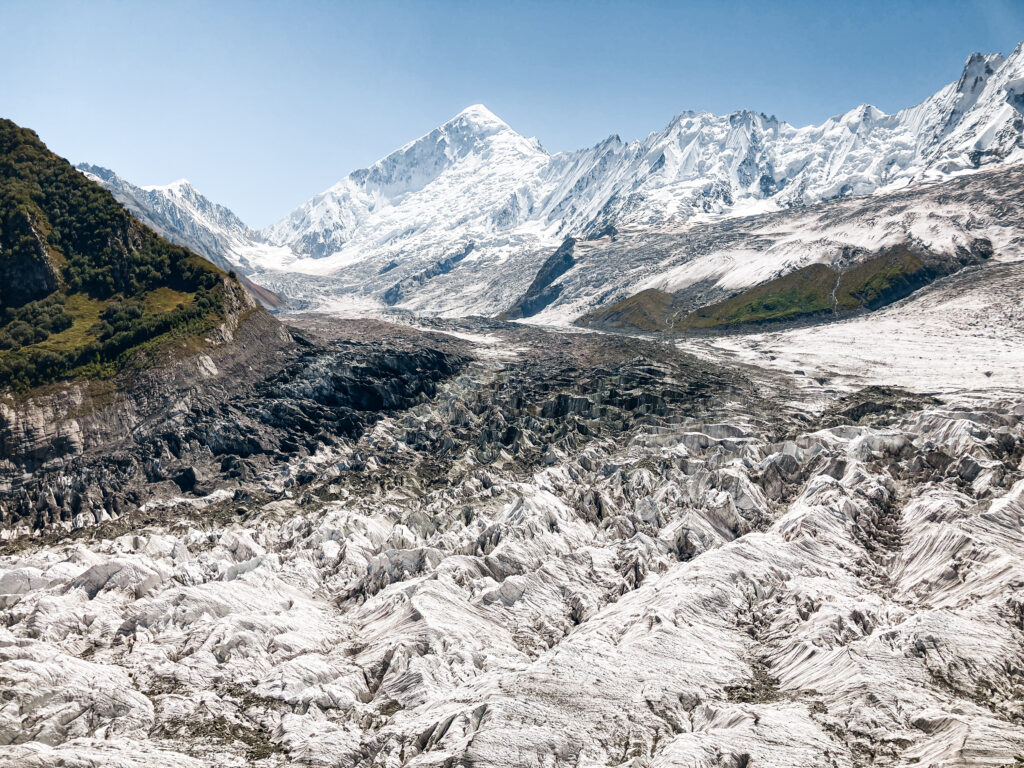 Viewpoint of Diran Peak and glaciers
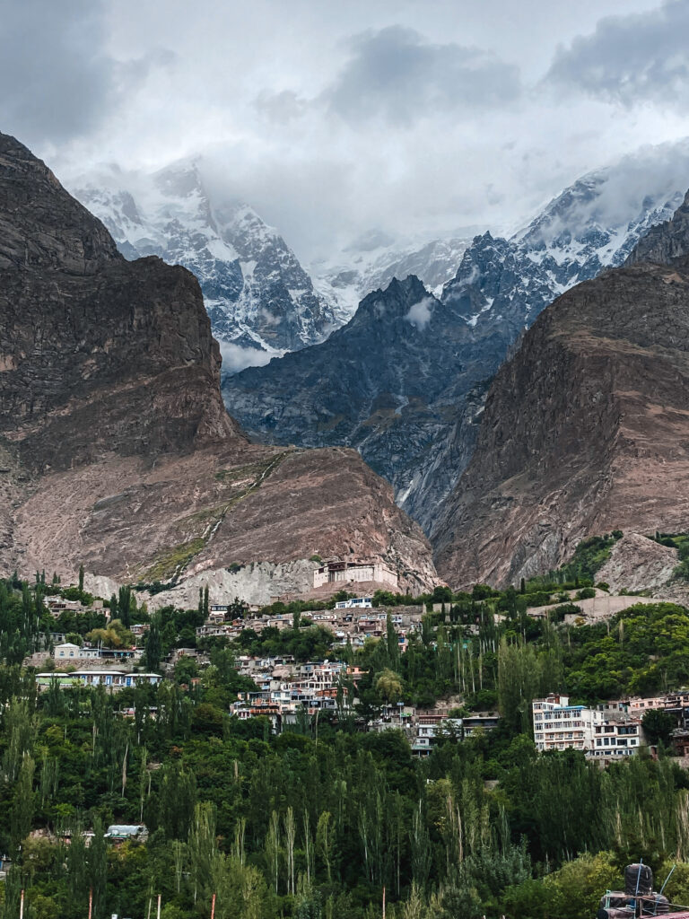
Aliabad and Karimabad
After Minapin, the next major stop is Aliabad, the central transport hub of Hunza. From here, a short ride uphill takes you to Karimabad, the cultural and historical heart of the valley. Here, you’ll find two of the most iconic landmarks in Hunza: the 700-year-old Baltit Fort, perched dramatically on a cliff edge, and the beautifully restored Altit Fort, with its serene gardens and panoramic views.
Karimabad is also a great place to relax and slow down – whether you’re sipping apricot juice on a guesthouse terrace, wandering through stone alleys, or hiking up to Eagle’s Nest for unforgettable sunset views.
For more information on trekking in Hunza and other regions, check out my Ultimate Guide to Trekking in Pakistan.
Where to Stay in Karimabad
Karimabad is one of the most popular stops along the Karakoram Highway and for good reason. Perched high above the Hunza River with sweeping views of Ultar Sar, Diran, Rakaposhi, and other 7000+meters giants, it’s the perfect place to slow down for a few days. The town has plenty of guesthouses and small hotels scattered along its steep lanes, catering to all budgets.
For budget travellers, there are many family-run guesthouses offering basic rooms with private bathrooms, hot showers, and sometimes breakfast included. Mid-range hotels in Karimabad often have terraces with panoramic views, on-site restaurants, and more modern facilities.
Karimabad is compact, so you can walk between most guesthouses and attractions. Staying near Baltit Fort or along the main street makes it easy to find food and transport, while quieter spots further up the hill offer unbeatable mountain views.
During my time in Pakistan I made Karimabad one of my main bases and I ended up staying there for a while. During that time, I stayed at Backpackers Stories by Old Hunza Inn which belongs to the nicer guesthouse Old Hunza Inn. The staff was great, the internet worked pretty well for Hunza but the best thing about this guesthouse was definitely the views over the Hunza Valley with views of Diran Peak, Rakaposhi and other giants. I stayed in the cheaper backpacker rooms and ended up paying around 4000 PKR for a double room. This guesthouse is also a main backpackers hub so it’s easier to meet other fellow travellers.
Tip: In peak summer (June–August) and during blossom season (April), Karimabad fills up fast so booking ahead can save you from having to wander the steep streets with your backpack.
Atabad Lake and Baskoshi Meadows Trek
Further north along the KKH lies Attabad Lake, a surreal body of turquoise water formed after a massive landslide in 2010. The disaster buried part of the old highway, and today, new tunnels cut dramatically through the cliffs beside the lake, offering some of the most scenic driving views in the country. You can stop here for a boat ride on the lake, grab tea at a lakeside café, or just marvel at the scenery. It’s touristy, yes, but undeniably beautiful.
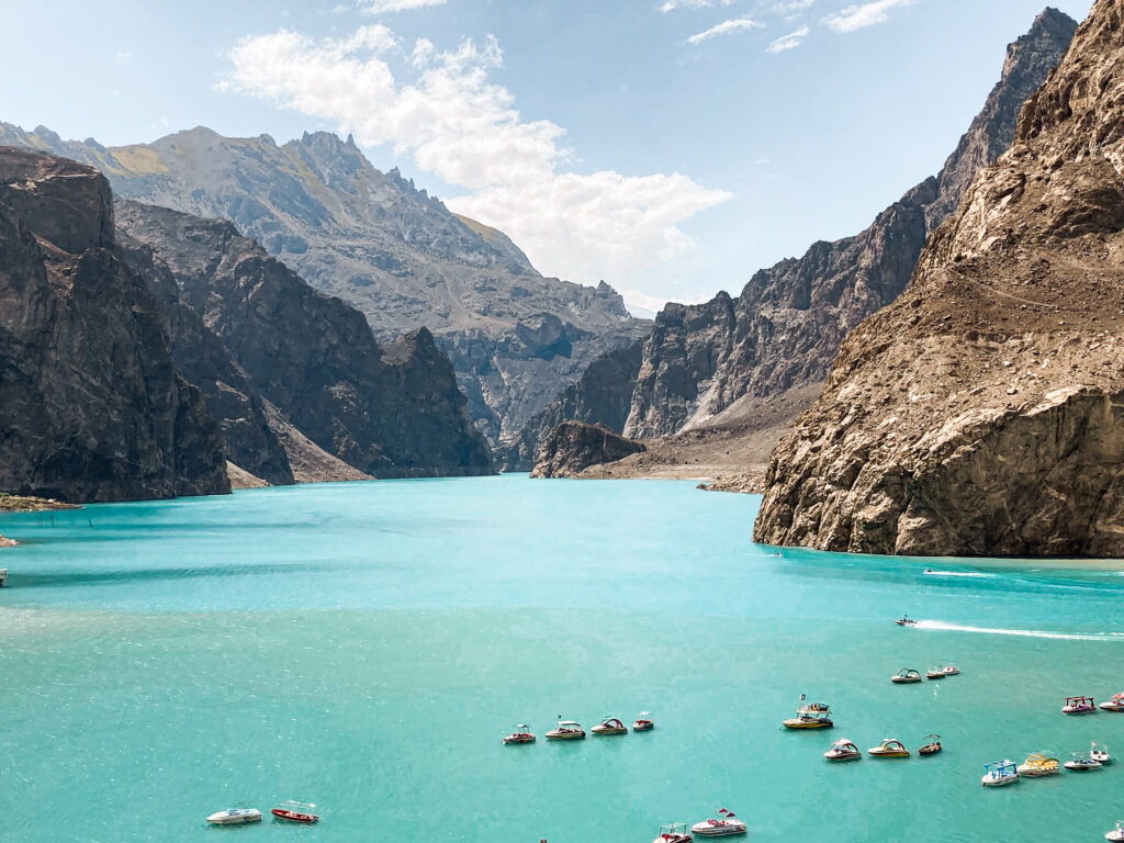 Attabad Lake
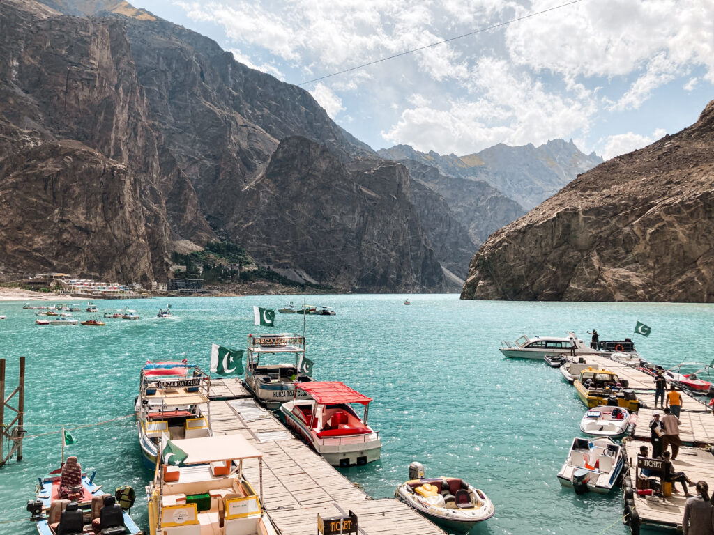 Boats for tourists at Attabad Lake
For those seeking a quieter experience away from the crowds, the trek to Baskochi Meadows is a hidden treasure. The trail begins right off the KKH, just south of Attabad, and climbs steadily to reach a high, grassy plateau overlooking the vibrant turquoise lake. It’s a half-day to full-day hike, depending on your pace, and doesn’t require a guide or technical gear – just water, snacks, and a decent level of fitness. Few travellers know about this trail, which makes the views feel even more special.
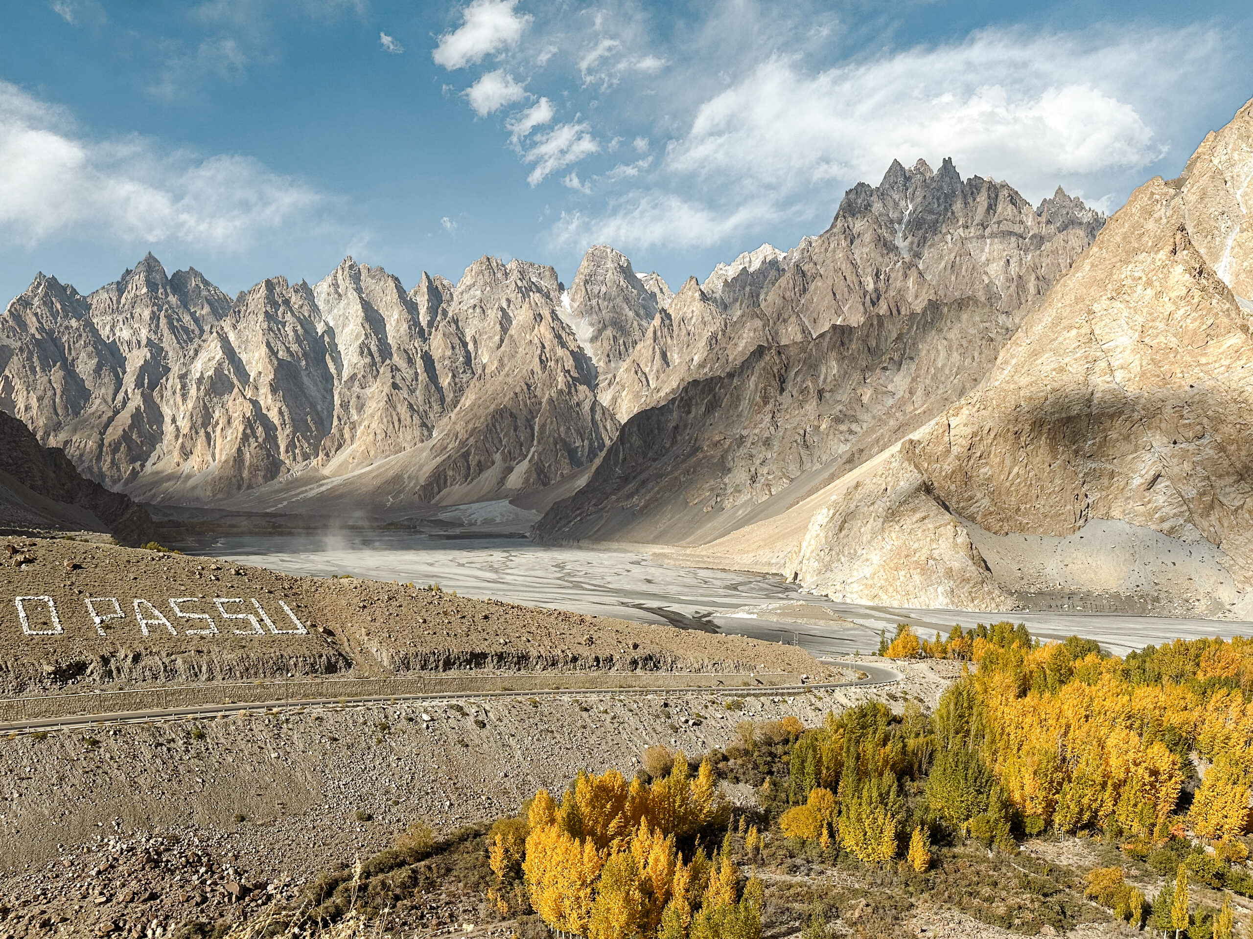
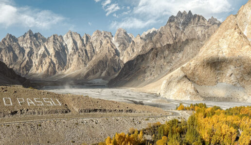
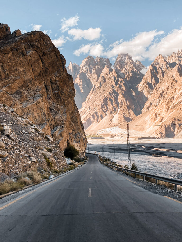
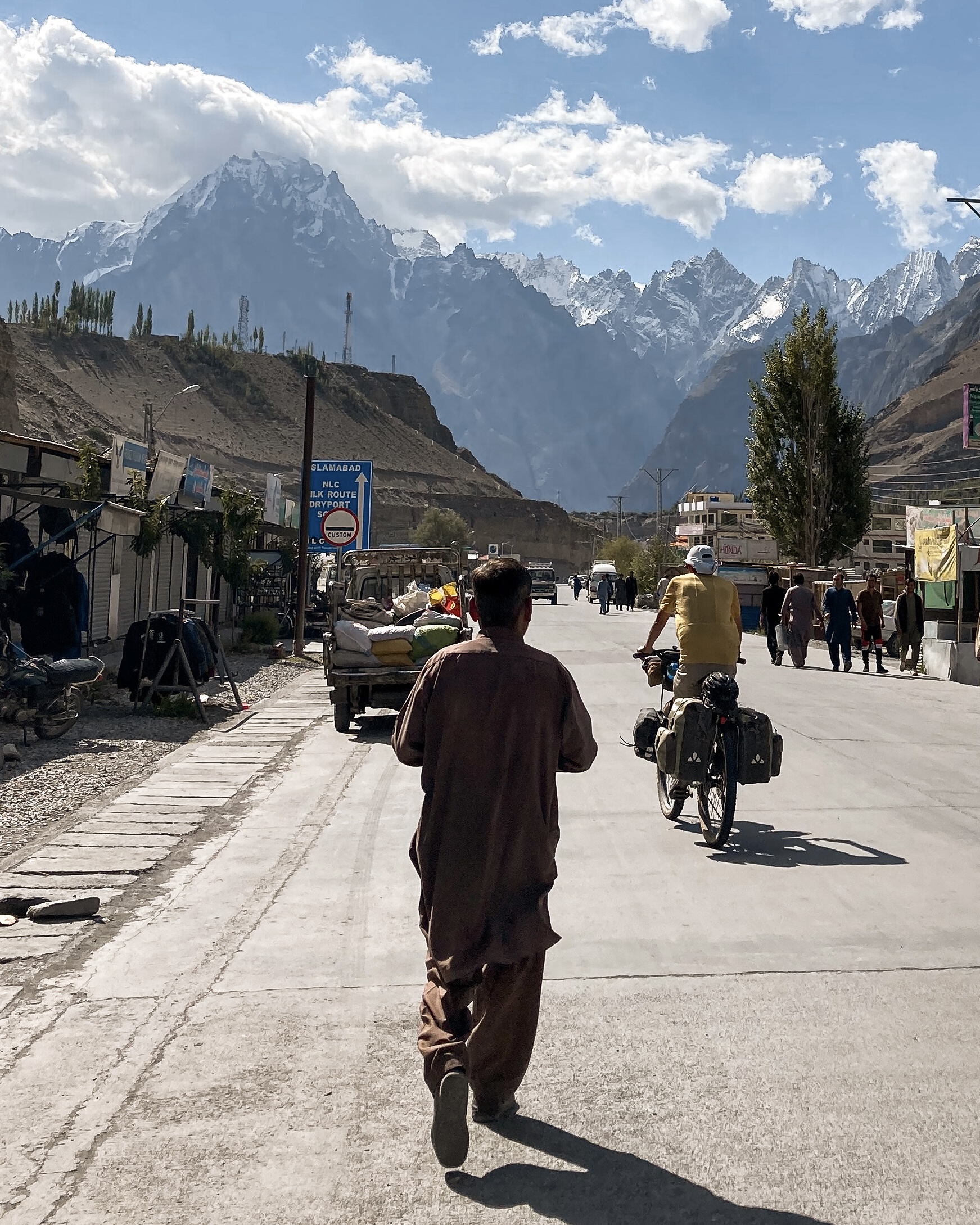
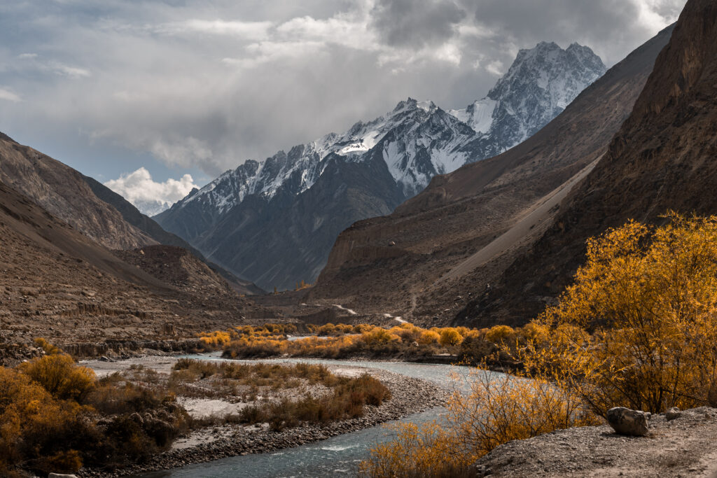
Passu & Gulkhin: Peaks, Glaciers and Villages
Beyond Attabad, the landscape opens into Gojal, Upper Hunza, home to some of the most dramatic scenery on the entire KKH and my personal favourite section. Passu is instantly recognisable thanks to the jagged, cathedral-like Passu Cones, which rise up like a crown behind the village. It’s a peaceful place to spend a night, especially if you want to hike to Passu Glacier Viewpoint or the nearby Hussaini Suspension Bridge.
 KKH – Passu Cones
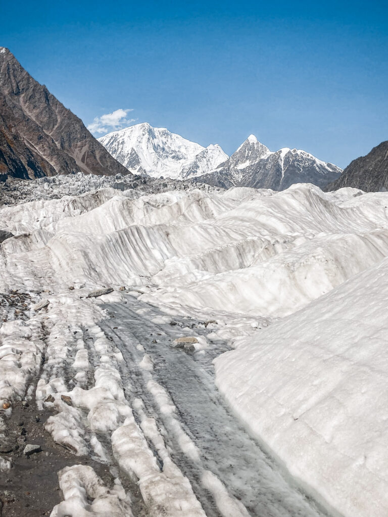 Crossing the Passu Glacier
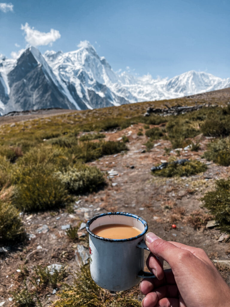 Trekking near Passu – Patundas Meadows
Just before reaching Passu, the villages of Gulmit and Ghulkin offer a more authentic, lived-in feel. With traditional stone houses, warm guesthouses, and sweeping views over the Ghulkin Glacier, this area is perfect for those looking to slow down. It’s a wonderful place to stay a night or two, soak in the mountain silence, and experience the rhythms of daily life in these remote communities.
For more information on different treks you could do while staying in Passu, check out my Ultimate Guide to Trekking in Pakistan.
Where to Stay in Passu and Around
Passu is a tiny village surrounded by some of the most dramatic scenery in all of Hunza with the jagged Passu Cones towering above and glaciers spilling down the valleys. Accommodation here is limited compared to Karimabad, but what’s available is usually family-run, friendly, and offers jaw-dropping views right from your room.
Budget travellers will find several guesthouses along the main road offering simple rooms with the occasional hot shower.
Right by the main road there’s the Cathedral Guesthouse, which is a very simple dormitory style budget place to stay but it has incredible views over the Passu Cones. It cost 2000 PKR (6.5€) for a bed in a traditional Pakistani house. The owner was nice and even offered us some fresh peaches from his garden.
Also before Passu and on the KKH there’s Rehman Backpacker Hostel, which is a good place to stop if you wanna be on the main road. However, if you have some time I’d recommend to stay in Rehman’s Homestay instead, which is in the close-by village of Ghulkin. There you’ll have the chance to stay with a local family and have a more in-depth understanding what is like to live in a small mountain village in Pakistan. Staying at this homestay was one of my favourite things I did in my entire time in Pakistan and ended up staying there for over a month. The family that runs it are amazing hosts who treat every guest like part of their family. Also Rehman is very knowledgeable about the area and can help you arrange guides for treks or other off the beaten path places you might wanna go.
Sost and Khunjerab Pass (Chinese Border)
Sost is the final town along the Karakoram Highway before the Chinese border. Though not the most scenic stop, it’s an important logistical hub, this is where immigration formalities for travellers heading into China are handled, and where cargo trucks rumble through from the Khunjerab Pass. There are a few basic guesthouses and restaurants here, but most travellers use Sost as a short stopover or a base for a day trip to the border. I hitchhiked from Passu to Sost and then from Sost to the border and back.
From Sost, it’s a stunning 90-kilometre drive to the Khunjerab Pass, the highest paved international border crossing in the world at 4,693 metres. The landscape transforms dramatically: narrow gorges and terraced fields give way to wide alpine plateaus, yaks grazing beside the road, and snow-dusted peaks stretching into the sky. To enter this area, you’ll need to pay a Khunjerab National Park entrance fee, collected at the park gate before the ascent. The amount varies depending on whether you’re a local or a foreigner, but expect to pay the steep fee of 5600 PKR (20$) as a tourist (cash only).
At the border, you’ll find a large gate marking the official entrance into China’s Xinjiang region. While the air is thin and the winds sharp, the sheer remoteness and grandeur of this high-mountain frontier make it a memorable highlight and a powerful end (or beginning) to your Karakoram journey.
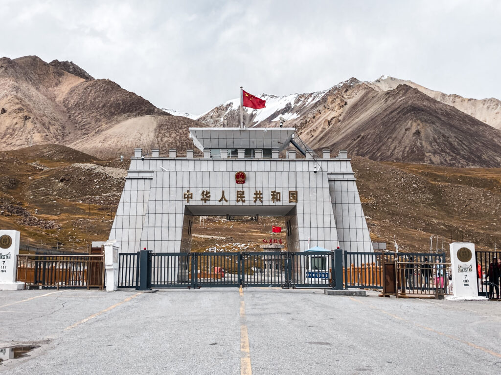 Chinese Border
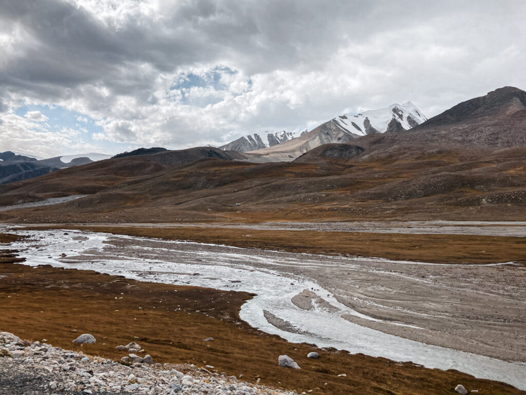 Khunjerab Pass
Detours to Misgar and Chapursan Valleys
If you’re looking to venture even further off the beaten path, the area around Sost offers access to some of the most remote and untouched valleys in Pakistan.
One of the most intriguing is Misgar Valley, a rugged and windswept region nestled near the tri-border intersection of Pakistan, China, and Afghanistan. This high-altitude valley once lay along a branch of the ancient Silk Road and today remains home to a small Wakhi-speaking community. Misgar’s expansive meadows and surrounding mountains offer a stark beauty that feels worlds away from the more travelled parts of Hunza.
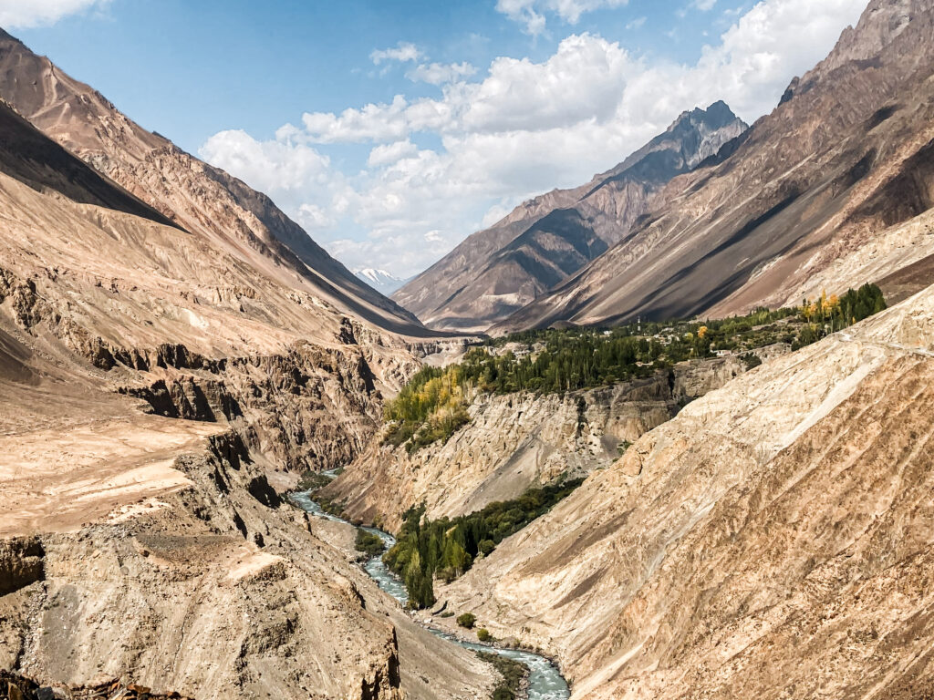 Journey towards Misgar Valley
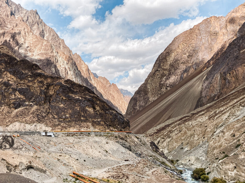 Deep into Misgar Valley
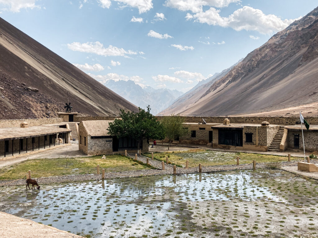
A highlight here is the historic Misgar Fort (also called Kalam Darchi Fort), perched near the strategic confluence of borders. Built by the British in the early 20th century, the fort once served as a military outpost to monitor cross-border movement and remains a fascinating, if remote, relic of colonial-era frontier politics.
Another valley worth detouring to is Chapursan offshoots worth exploring include Chapursan Valley, further west from Sost near the Afghan border. It’s a long and bumpy ride to reach the final village, but the incredible landscapes and the warm hospitality of the community make it well worth the effort.
 On the road in Chapursan Valley
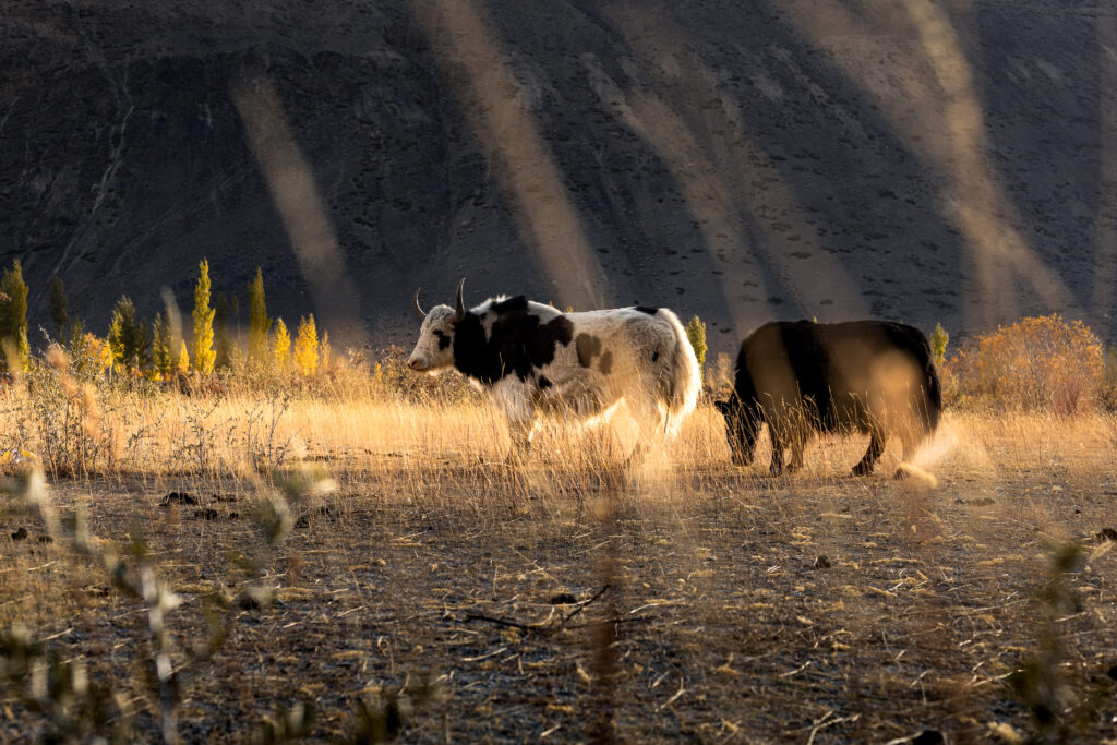 Yaks Grazing in Chapursan Valley
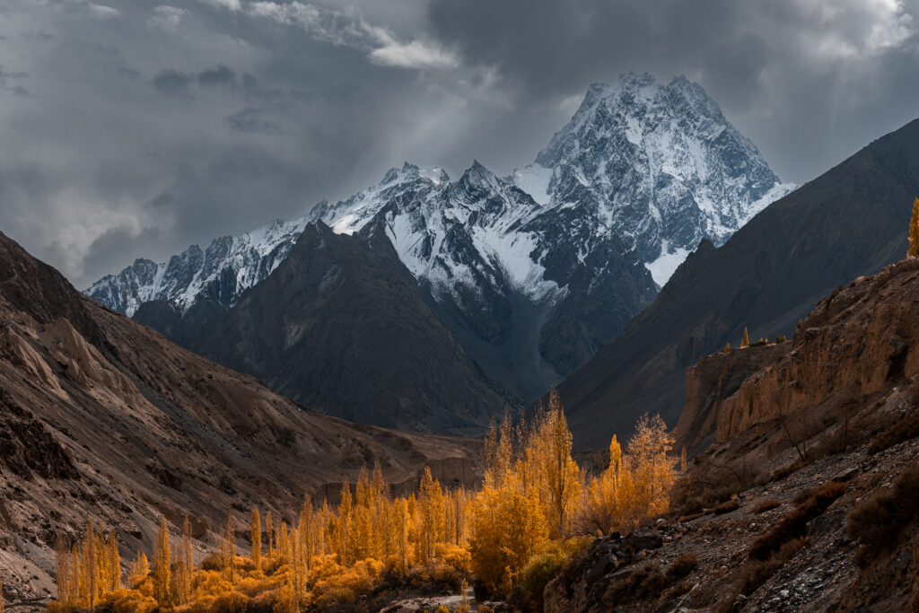 Autumn Colours in Chapursan Valley
These valleys offer a deeper look into life in Pakistan’s far north – untouched by tourism, rich in culture, and full of raw natural beauty. If time and conditions allow, they’re among the most rewarding detours you can take from the Karakoram Highway. For more details on these remote valleys and other check out this post.
Final Thoughts
Travelling the Karakoram Highway is more than just a journey along one of the world’s highest paved roads, it’s an immersion into some of Pakistan’s most breathtaking landscapes and vibrant cultures. From the bustling Islamabad to the tranquil villages of Hunza and the windswept heights of Khunjerab Pass, the KKH offers a tapestry of experiences that challenge, inspire, and connect. With patience, openness, and a spirit of adventure, this iconic route reveals the warmth of its people and the raw beauty of the mountains in ways no guided tour can match. Whether you’re seeking epic treks, historic tales, or simple moments of mountain silence, the Karakoram Highway invites you to explore beyond the road and into the heart of the wild north.
More Pakistan Travel Guides
If you’re planning to travel Pakistan independently, these in-depth guides will help you navigate the country, travel on a budget, and explore far beyond the usual routes: